Skip to content
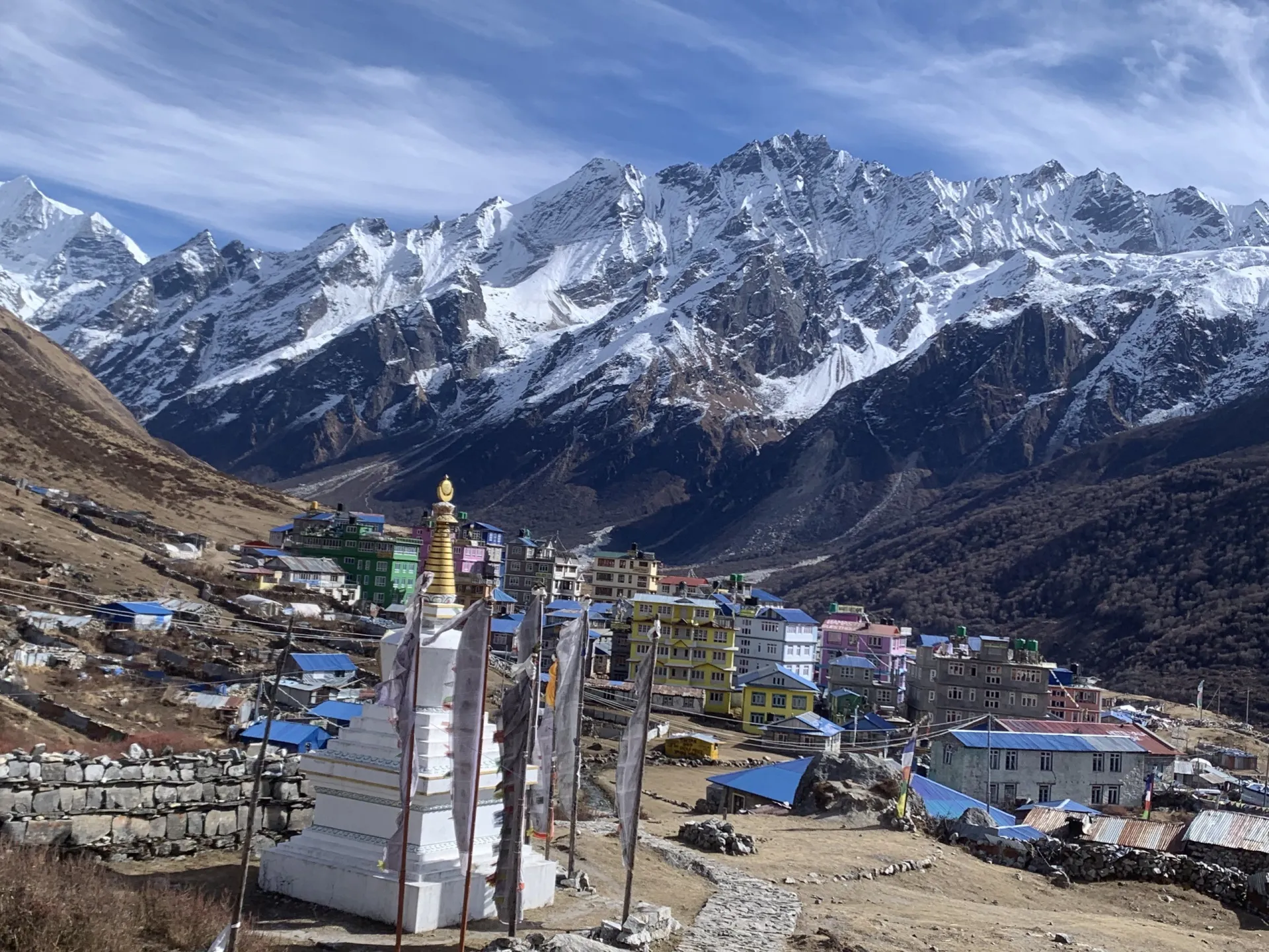
Kyanjin Gompa's colourful lodges below a stupa and glaciated Langtang peaks

Langtang Valley Trek

The closest big-mountain valley to Kathmandu — glaciers, Tamang culture, and a summit choice for every fitness level.

8 Days / 7 Nights Moderate 4,984 m (Tserko Ri) Langtang Region, Nepal
Starting from $720 per person

Overview

The Langtang Valley Trek climbs the closest big-mountain valley to Kathmandu — a single dramatic gorge that rises from subtropical forest to a glacial amphitheater beneath Langtang Lirung (7,227 m) in just three days. The route follows a proven structure: a steady approach, a short push into Kyanjin Gompa, a dedicated summit day, and a two-stage descent.

Along the way the trail passes through genuine Tamang and Tibetan villages, dense forest alive with langur monkeys, birdlife, and the chance of red pandas, and the poignant memorial at the site of the original Langtang Village, buried by the earthquake-triggered avalanche of April 2015. From Kyanjin Gompa, ringed by 6,000–7,000 m peaks, trekkers choose between two summit days — Kyanjin Ri (4,773 m) for most groups, or Tserko Ri (4,984 m) for strong, symptom-free trekkers wanting a bigger day and wider panorama.

Highlights

  • Close-up views of Langtang Lirung (7,227 m) filling the head of the valley
  • Kyanjin Gompa — a historic monastery, Swiss-established cheese factory, and famous bakeries
  • A summit-day choice between Kyanjin Ri (4,773 m) and Tserko Ri (4,984 m)
  • Genuine Tamang and Tibetan culture along the trail
  • The Langtang Village earthquake memorial and the rebuilt village supporting the valley's recovery
  • Dense subtropical forest gorge with waterfalls, langur monkeys, and birdlife

Photos

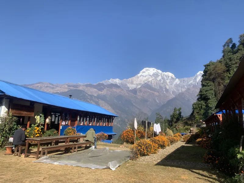
TODO describe: Langtang Valley Trek

TODO describe: Langtang Valley Trek

TODO describe: Langtang Valley Trek

TODO describe: Langtang Valley Trek

TODO describe: Langtang Valley Trek

TODO describe: Langtang Valley Trek

TODO describe: Langtang Valley Trek

TODO describe: Langtang Valley Trek

TODO describe: Langtang Valley Trek

TODO describe: Langtang Valley Trek

TODO describe: Langtang Valley Trek

TODO describe: Langtang Valley Trek

TODO describe: Langtang Valley Trek

TODO describe: Langtang Valley Trek

TODO describe: Langtang Valley Trek

TODO describe: Langtang Valley Trek

TODO describe: Langtang Valley Trek

TODO describe: Langtang Valley Trek

TODO describe: Langtang Valley Trek

TODO describe: Langtang Valley Trek

TODO describe: Langtang Valley Trek

TODO describe: Langtang Valley Trek

TODO describe: Langtang Valley Trek

TODO describe: Langtang Valley Trek

The Shape of the Trek

Sleep altitude each night — the acclimatization pattern at a glance.

1,000 1,500 2,000 2,500 3,000 3,500 4,000 3,870 m Day 1 Day 8
1,460 m · Day 1 · Syabrubesi
2,470 m · Day 2 · Lama Hotel
3,430 m · Day 3 · Langtang Village
3,870 m · Day 4 · Kyanjin Gompa
3,870 m · Day 5 · Kyanjin Gompa
2,470 m · Day 6 · Lama Hotel
1,460 m · Day 7 · Syabrubesi
1,400 m · Day 8 · Kathmandu

Departure Dates

No scheduled dates for this trek yet — we run it on the dates that suit you. If you’re planning a trek for a group of friends or family, talk to our specialist and we’ll build it around you.

Talk to our specialist

The route

Route Map

4 stops · 4 trekking sections

NEPALSyabrubesiSTARTLama HotelKyanjin GompaLama HotelSyabrubesiKathmanduEND
By road On foot

Day-by-Day Itinerary

8 days on the trail, mapped one by one — no need to expand anything.

Day of 8

Day 1

Drive Kathmandu to Syabrubesi

Day 1

Drive Kathmandu to Syabrubesi

Overnight: Syabrubesi

The drive north through Trishuli and Dhunche winds along dramatic, rough mountain roads with views of Ganesh Himal, entering Langtang National Park at the Dhunche checkpoint where permits are registered. Syabrubesi is a lively roadside town at the confluence of two rivers.

Day 1 of 8

Drive Kathmandu to Syabrubesi

Altitude: 1,400 m to 1,460 m
Time: 7–8 hours drive
Overnight: Syabrubesi

The drive north through Trishuli and Dhunche winds along dramatic, rough mountain roads with views of Ganesh Himal, entering Langtang National Park at the Dhunche checkpoint where permits are registered. Syabrubesi is a lively roadside town at the confluence of two rivers.

Leave Kathmandu by 6–7 am, as the road deteriorates after Trishuli and delays are normal.
Day 2

Syabrubesi to Lama Hotel

Day 2

Syabrubesi to Lama Hotel

Overnight: Lama Hotel

The trail crosses the Bhote Koshi and follows the Langtang Khola upstream through dense subtropical forest — a gorge alive with waterfalls, langur monkeys, and birdlife, where lucky trekkers spot red pandas. It climbs steadily through Bamboo and Rimche to Lama Hotel, a cluster of lodges in the forested gorge.

Day 2 of 8

Syabrubesi to Lama Hotel

Altitude: 1,460 m to 2,470 m (+1,010 m, all at forgiving low altitude)
Time: ~11–12 km, 6–7 hours
Overnight: Lama Hotel

The trail crosses the Bhote Koshi and follows the Langtang Khola upstream through dense subtropical forest — a gorge alive with waterfalls, langur monkeys, and birdlife, where lucky trekkers spot red pandas. It climbs steadily through Bamboo and Rimche to Lama Hotel, a cluster of lodges in the forested gorge.

Day 3

Lama Hotel to Langtang Village

Day 3

Lama Hotel to Langtang Village

Overnight: Langtang Village

The forest gradually opens as the trail climbs through Ghodatabela (an army checkpost where permits are checked) and Thangshyap, and the valley suddenly widens into classic U-shaped glacial country with Langtang Lirung filling its head. Trekkers pass the site of the original Langtang Village, buried by the earthquake-triggered avalanche of April 2015, where a memorial to the hundreds who died is a moving stop; the rebuilt village sits just beyond.

Day 3 of 8

Lama Hotel to Langtang Village

Altitude: 2,470 m to 3,430 m (+960 m — the trek's biggest sleeping jump)
Time: ~14–15 km, 6–7 hours
Overnight: Langtang Village

The forest gradually opens as the trail climbs through Ghodatabela (an army checkpost where permits are checked) and Thangshyap, and the valley suddenly widens into classic U-shaped glacial country with Langtang Lirung filling its head. Trekkers pass the site of the original Langtang Village, buried by the earthquake-triggered avalanche of April 2015, where a memorial to the hundreds who died is a moving stop; the rebuilt village sits just beyond.

If symptoms build, stopping short at Thangshyap (3,140 m) and making up the distance on the next day's short stage is an easy, sensible adjustment.

Day 4

Langtang Village to Kyanjin Gompa

Day 4

Langtang Village to Kyanjin Gompa

Overnight: Kyanjin Gompa

A short, beautiful morning passes long mani walls, including one of Nepal's largest, and the yak pastures of Mundu and Sindum, arriving at Kyanjin Gompa by lunch — a lodge village ringed by 6,000–7,000 m peaks beneath the icefalls of Langtang Lirung. The afternoon is spent visiting the historic gompa, the cheese factory established with Swiss help in the 1950s, and the bakeries.

Day 4 of 8

Langtang Village to Kyanjin Gompa

Altitude: 3,430 m to 3,870 m (+440 m)
Time: ~6–7 km, 3–4 hours
Overnight: Kyanjin Gompa

A short, beautiful morning passes long mani walls, including one of Nepal's largest, and the yak pastures of Mundu and Sindum, arriving at Kyanjin Gompa by lunch — a lodge village ringed by 6,000–7,000 m peaks beneath the icefalls of Langtang Lirung. The afternoon is spent visiting the historic gompa, the cheese factory established with Swiss help in the 1950s, and the bakeries.

A short stroll toward the Lirung glacier viewpoint (30–45 min) stretches the legs without taxing acclimatization.

Day 5

Summit Day: Kyanjin Ri or Tserko Ri

Day 5

Summit Day: Kyanjin Ri or Tserko Ri

Overnight: Kyanjin Gompa

Kyanjin Ri climbs directly above the village — steep but straightforward — to prayer flags and a full panorama of Langtang Lirung, Kimshung, Yansa Tsenji, and the Ganja La side of the valley; it is the realistic choice for most trekkers. Tserko Ri is a long pre-dawn push up the valley for a higher, wider panorama stretching to Shishapangma in Tibet on clear days — a genuinely big day at altitude best saved for strong, symptom-free groups.

Day 5 of 8

Summit Day: Kyanjin Ri or Tserko Ri

Altitude: 3,870 m up to 4,773 m or 4,984 m
Time: Kyanjin Ri: ~900 m ascent, 4–5 hours round trip. Tserko Ri: ~1,100 m ascent, 7–8 hours round trip, starting ~5 am
Overnight: Kyanjin Gompa

Kyanjin Ri climbs directly above the village — steep but straightforward — to prayer flags and a full panorama of Langtang Lirung, Kimshung, Yansa Tsenji, and the Ganja La side of the valley; it is the realistic choice for most trekkers. Tserko Ri is a long pre-dawn push up the valley for a higher, wider panorama stretching to Shishapangma in Tibet on clear days — a genuinely big day at altitude best saved for strong, symptom-free groups.

Undecided? Climb Kyanjin Ri today and, with a spare day and strength, add Tserko Ri tomorrow.

Day 6

Kyanjin Gompa to Lama Hotel

Day 6

Kyanjin Gompa to Lama Hotel

Overnight: Lama Hotel

The route retraces the valley in one long, mostly-downhill push, passing Langtang Village and its memorial, through Ghodatabela, and back into the forest to Lama Hotel.

Day 6 of 8

Kyanjin Gompa to Lama Hotel

Altitude: 3,870 m to 2,470 m (−1,400 m)
Time: ~20–21 km, 6–7 hours
Overnight: Lama Hotel

The route retraces the valley in one long, mostly-downhill push, passing Langtang Village and its memorial, through Ghodatabela, and back into the forest to Lama Hotel.

If 20 km feels too much, splitting the descent with a night at Thangshyap or Ghodatabela keeps it gentle.

Day 7

Lama Hotel to Syabrubesi

Day 7

Lama Hotel to Syabrubesi

Overnight: Syabrubesi

The final descent runs through the gorge forest, growing warmer with every hour and offering a last chance at red panda luck, back to Syabrubesi by early afternoon for hot showers, cold drinks, and a celebratory dinner.

Day 7 of 8

Lama Hotel to Syabrubesi

Altitude: 2,470 m to 1,460 m
Time: ~11–12 km, 5–6 hours
Overnight: Syabrubesi

The final descent runs through the gorge forest, growing warmer with every hour and offering a last chance at red panda luck, back to Syabrubesi by early afternoon for hot showers, cold drinks, and a celebratory dinner.

Day 8

Drive Syabrubesi to Kathmandu

Day 8

Drive Syabrubesi to Kathmandu

Overnight: Kathmandu

The long, winding drive back through Dhunche and Trishuli returns to Kathmandu, arriving by late afternoon.

Day 8 of 8

Drive Syabrubesi to Kathmandu

Time: 7–8 hours drive
Overnight: Kathmandu

The long, winding drive back through Dhunche and Trishuli returns to Kathmandu, arriving by late afternoon.

Essential Gear

  • Sleeping bag rated to about −10 °C (colder for winter)
  • Warm layers and a down jacket for summit morning
  • Headlamp (for a Tserko Ri pre-dawn start)
  • Trekking poles (the Day 6 descent runs 20 km)
  • Water purification tablets or filter
  • Microspikes for winter and early-spring summit attempts

Good to Know

  • There are no ATMs beyond Kathmandu on this route.
  • Day 3's ascent from Lama Hotel to Langtang Village is where AMS symptoms most often surface — know the symptoms and never push higher if they worsen; Thangshyap and Ghodatabela offer easy intermediate stops.
  • The Ris (Kyanjin Ri and Tserko Ri) are non-technical but high — turn back in deteriorating weather.
  • Insurance covering trekking to 5,000 m and helicopter evacuation is recommended.
  • Staying and spending in Langtang Village carries real meaning — the valley rebuilt itself after the 2015 earthquake largely on trekking income.
  • Optional extension: from the lower valley, climb south to the sacred alpine Gosaikunda Lakes (4,380 m) and exit via Sundarijal or Dhunche, adding 3–4 days.
  • Winter (Dec–Feb) is cold but feasible to Kyanjin, with microspikes advised for the Ris; monsoon (June–September) is not recommended due to a landslide-prone road and trail.

Ready to trek Langtang Valley Trek?

Talk to a specialist who has personally trekked every route we sell — no call center, no script.

Call / WhatsApp Plan My Trek