Skip to content
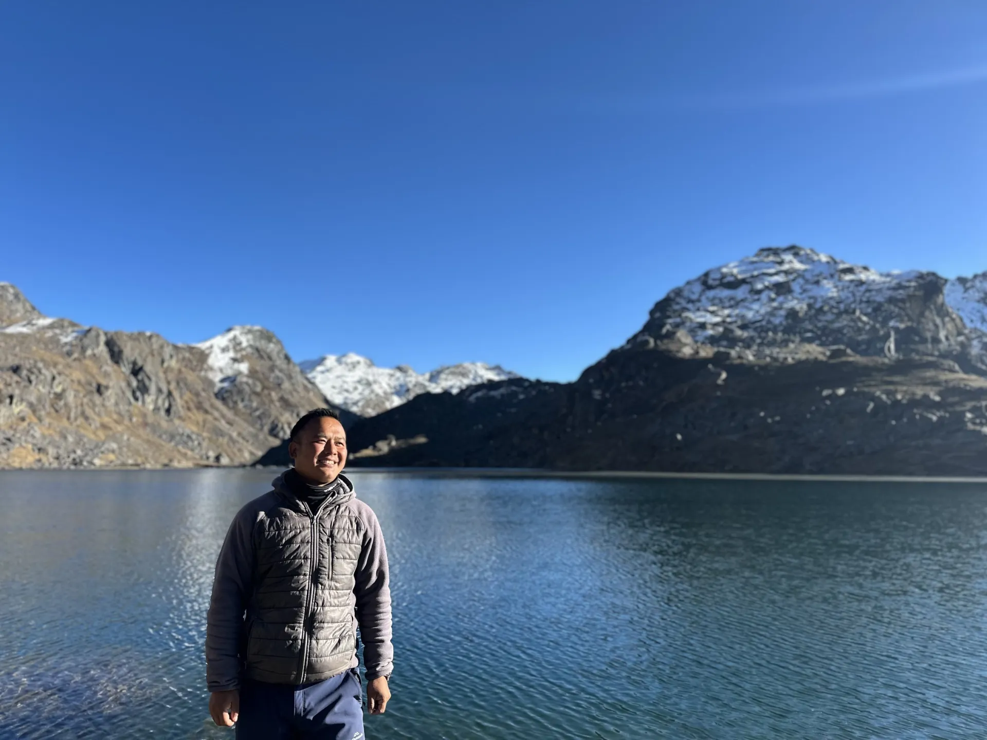
A guide standing beside the still, deep-blue water of the sacred alpine lake Gosaikunda

Langtang – Gosaikunda – Helambu Trek

Three treks in one — glacial Langtang valley, the sacred alpine lakes of Gosaikunda, and Helambu ridge villages, finishing on Kathmandu's doorstep.

13 Days / 12 Nights Challenging 4,984 m (Tserko Ri) Langtang Region, Nepal
Starting from $1,150 per person

Overview

A 13-day grand traverse from Kathmandu combining three treks in one: the glacial Langtang valley beneath Langtang Lirung (7,227 m), the sacred alpine lakes of Gosaikunda (4,380 m), and the village ridge-walking of Helambu. Highest sleeping point is Gosaikunda (4,380 m); highest points reached are Tserko Ri (4,984 m) and Lauribina Pass (4,610 m).

The route is deliberately sequenced Langtang-first: five days climbing to 3,870–4,984 m in the Langtang valley acclimatize trekkers before the two big sleeping-altitude gains into Gosaikunda and over Lauribina Pass. The trek ends via Helambu and Sundarijal on Kathmandu's own doorstep — a rare Nepal itinerary with no return flight or long exit drive.

Highlights

  • Kyanjin Gompa and the glacial Langtang valley beneath Langtang Lirung (7,227 m)
  • Summit options to Kyanjin Ri (4,773 m) or Tserko Ri (4,984 m), with views to Shishapangma in Tibet
  • The sacred Gosaikunda lakes (4,380 m), a major Hindu pilgrimage site
  • Crossing Lauribina Pass (4,610 m), the trek's high point crossing
  • Classic Helambu ridge-walking through Tamang and Sherpa villages
  • Rebuilt Langtang Village and its 2015 earthquake memorial
  • A finish at Sundarijal on Kathmandu's doorstep, with no return flight or long road day

Photos

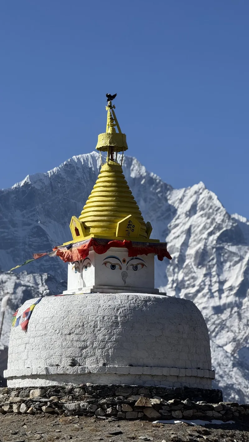
TODO describe: Langtang – Gosaikunda – Helambu Trek

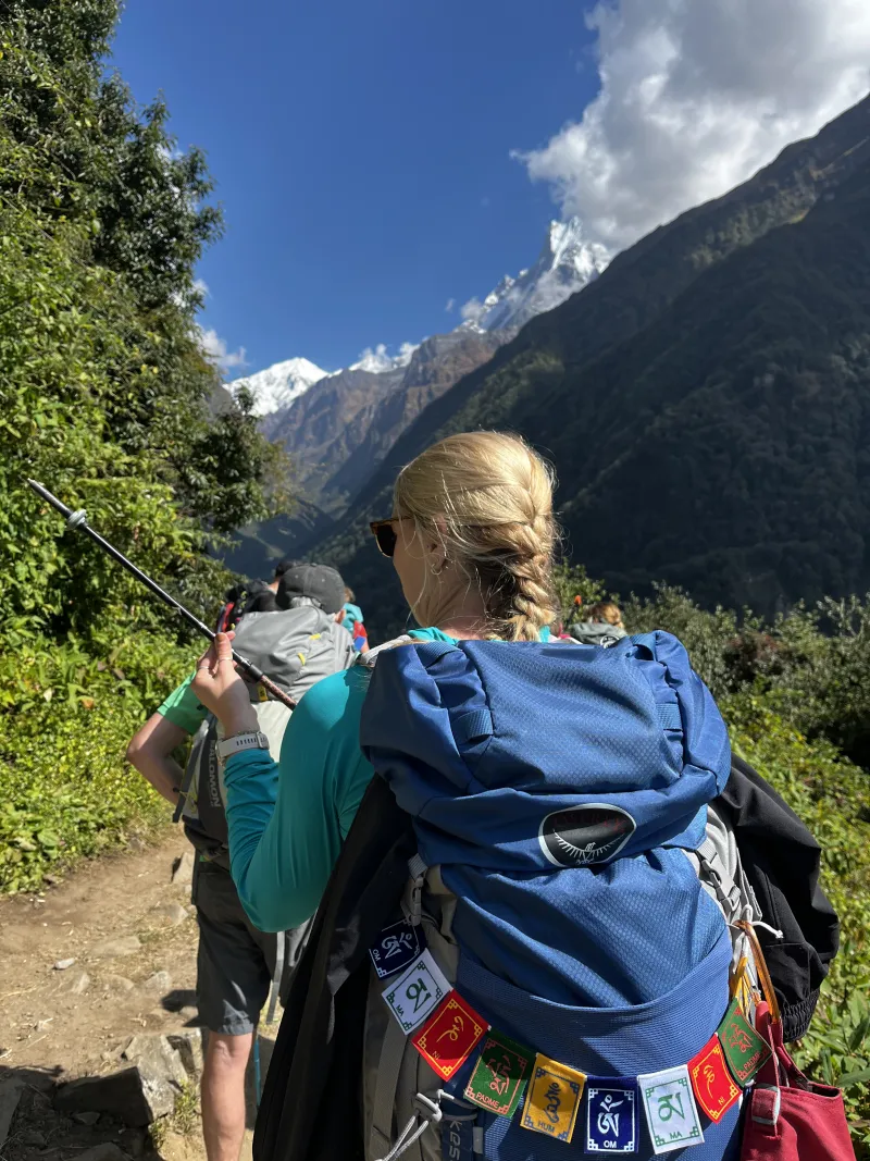
TODO describe: Langtang – Gosaikunda – Helambu Trek

TODO describe: Langtang – Gosaikunda – Helambu Trek

TODO describe: Langtang – Gosaikunda – Helambu Trek

TODO describe: Langtang – Gosaikunda – Helambu Trek

TODO describe: Langtang – Gosaikunda – Helambu Trek

TODO describe: Langtang – Gosaikunda – Helambu Trek

TODO describe: Langtang – Gosaikunda – Helambu Trek

TODO describe: Langtang – Gosaikunda – Helambu Trek

TODO describe: Langtang – Gosaikunda – Helambu Trek

TODO describe: Langtang – Gosaikunda – Helambu Trek

TODO describe: Langtang – Gosaikunda – Helambu Trek

TODO describe: Langtang – Gosaikunda – Helambu Trek

TODO describe: Langtang – Gosaikunda – Helambu Trek

TODO describe: Langtang – Gosaikunda – Helambu Trek

TODO describe: Langtang – Gosaikunda – Helambu Trek

TODO describe: Langtang – Gosaikunda – Helambu Trek

TODO describe: Langtang – Gosaikunda – Helambu Trek

TODO describe: Langtang – Gosaikunda – Helambu Trek

TODO describe: Langtang – Gosaikunda – Helambu Trek

TODO describe: Langtang – Gosaikunda – Helambu Trek

TODO describe: Langtang – Gosaikunda – Helambu Trek

TODO describe: Langtang – Gosaikunda – Helambu Trek

TODO describe: Langtang – Gosaikunda – Helambu Trek

TODO describe: Langtang – Gosaikunda – Helambu Trek

TODO describe: Langtang – Gosaikunda – Helambu Trek

TODO describe: Langtang – Gosaikunda – Helambu Trek

TODO describe: Langtang – Gosaikunda – Helambu Trek

TODO describe: Langtang – Gosaikunda – Helambu Trek

TODO describe: Langtang – Gosaikunda – Helambu Trek

TODO describe: Langtang – Gosaikunda – Helambu Trek

TODO describe: Langtang – Gosaikunda – Helambu Trek

TODO describe: Langtang – Gosaikunda – Helambu Trek

TODO describe: Langtang – Gosaikunda – Helambu Trek

TODO describe: Langtang – Gosaikunda – Helambu Trek

TODO describe: Langtang – Gosaikunda – Helambu Trek

TODO describe: Langtang – Gosaikunda – Helambu Trek

TODO describe: Langtang – Gosaikunda – Helambu Trek

TODO describe: Langtang – Gosaikunda – Helambu Trek

The Shape of the Trek

Sleep altitude each night — the acclimatization pattern at a glance.

1,000 1,500 2,000 2,500 3,000 3,500 4,000 4,500 4,380 m Day 1 Day 13
1,460 m · Day 1 · Syabrubesi
2,470 m · Day 2 · Lama Hotel
3,430 m · Day 3 · Langtang Village
3,870 m · Day 4 · Kyanjin Gompa
3,870 m · Day 5 · Kyanjin Gompa
2,470 m · Day 6 · Lama Hotel
2,230 m · Day 7 · Thulo Syabru
3,330 m · Day 8 · Sing Gompa
4,380 m · Day 9 · Gosaikunda
3,430 m · Day 10 · Ghopte
2,470 m · Day 11 · Kutumsang
2,470 m · Day 12 · Chisapani
1,400 m · Day 13 · Kathmandu

Departure Dates

No scheduled dates for this trek yet — we run it on the dates that suit you. If you’re planning a trek for a group of friends or family, talk to our specialist and we’ll build it around you.

Talk to our specialist

The route

Route Map

9 stops · 9 trekking sections

NEPALSyabrubesiSTARTLama HotelKyanjin GompaLama HotelThulo SyabruGosaikundaGhopteKutumsangChisapaniKathmanduEND
By road On foot

Day-by-Day Itinerary

13 days on the trail, mapped one by one — no need to expand anything.

Day of 13

Day 1

Kathmandu to Syabrubesi

Day 1

Kathmandu to Syabrubesi

Overnight: Syabrubesi

Drive north through Trishuli and Dhunche on rough mountain roads, entering Langtang National Park at the Dhunche checkpoint. Overnight in the riverside town of Syabrubesi.

Day 1 of 13

Kathmandu to Syabrubesi

Altitude: 1,400 m → 1,460 m
Time: 7–8 hours (drive)
Overnight: Syabrubesi

Drive north through Trishuli and Dhunche on rough mountain roads, entering Langtang National Park at the Dhunche checkpoint. Overnight in the riverside town of Syabrubesi.

Leave Kathmandu by 6–7 am.
Day 2

Syabrubesi to Lama Hotel

Day 2

Syabrubesi to Lama Hotel

Overnight: Lama Hotel

Walk up the Langtang Khola gorge through dense forest — waterfalls, langurs, and red panda country — via Bamboo and Rimche to the lodge cluster at Lama Hotel.

Day 2 of 13

Syabrubesi to Lama Hotel

Altitude: 1,460 m → 2,470 m (+1,010 m at forgiving low altitude)
Time: 6–7 hours
Overnight: Lama Hotel

Walk up the Langtang Khola gorge through dense forest — waterfalls, langurs, and red panda country — via Bamboo and Rimche to the lodge cluster at Lama Hotel.

Day 3

Lama Hotel to Langtang Village

Day 3

Lama Hotel to Langtang Village

Overnight: Langtang Village

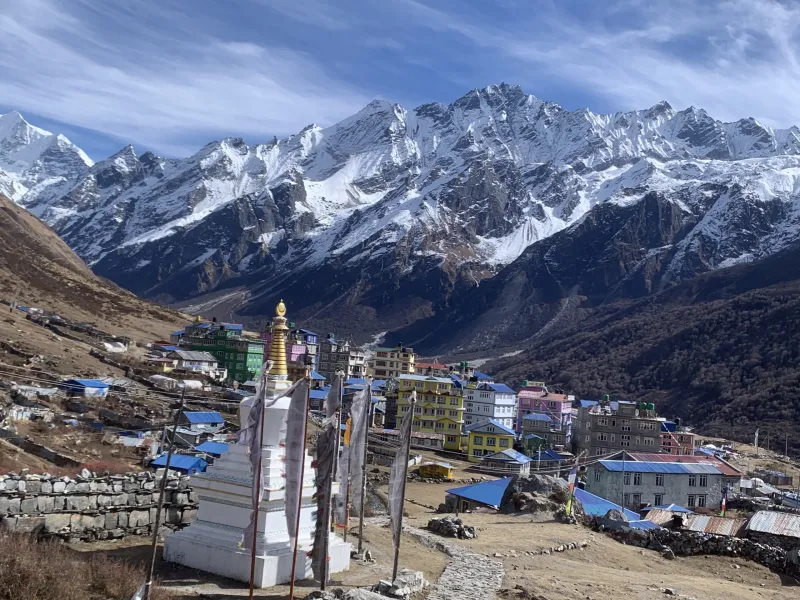
The valley opens past Ghodatabela and Thangshyap into glacial country beneath Langtang Lirung (7,227 m). Pass the 2015 earthquake memorial near the old village site before reaching rebuilt Langtang Village. This is the trek's first altitude pinch, so pace deliberately.

Day 3 of 13

Lama Hotel to Langtang Village

Altitude: 2,470 m → 3,430 m (+960 m)
Time: 6–7 hours
Overnight: Langtang Village

The valley opens past Ghodatabela and Thangshyap into glacial country beneath Langtang Lirung (7,227 m). Pass the 2015 earthquake memorial near the old village site before reaching rebuilt Langtang Village. This is the trek's first altitude pinch, so pace deliberately.

If AMS symptoms build, stopping at Thangshyap (3,140 m) and making it up on tomorrow's short stage is an easy adjustment.

Day 4

Langtang Village to Kyanjin Gompa

Day 4

Langtang Village to Kyanjin Gompa

Overnight: Kyanjin Gompa

A short morning past grand mani walls to Kyanjin Gompa, ringed by ice peaks. The afternoon is free for the historic gompa, the Swiss-founded cheese factory, and the bakeries — ideal acclimatization.

Day 4 of 13

Langtang Village to Kyanjin Gompa

Altitude: 3,430 m → 3,870 m (+440 m)
Time: 3–4 hours
Overnight: Kyanjin Gompa

A short morning past grand mani walls to Kyanjin Gompa, ringed by ice peaks. The afternoon is free for the historic gompa, the Swiss-founded cheese factory, and the bakeries — ideal acclimatization.

Day 5

Summit Day: Kyanjin Ri or Tserko Ri

Day 5

Summit Day: Kyanjin Ri or Tserko Ri

Overnight: Kyanjin Gompa

Kyanjin Ri suits most groups — a steep morning to a full panorama of the Lirung amphitheater. Tserko Ri is bigger still, reaching views to Shishapangma in Tibet, for strong, symptom-free parties. This day's acclimatization is what makes the entire Gosaikunda leg later in the trek safe.

Day 5 of 13

Summit Day: Kyanjin Ri or Tserko Ri

Altitude: 3,870 m → 4,773 m (Kyanjin Ri) or 4,984 m (Tserko Ri)
Time: Kyanjin Ri: 4–5 hours round trip; Tserko Ri: 7–8 hours, start ~5 am
Overnight: Kyanjin Gompa

Kyanjin Ri suits most groups — a steep morning to a full panorama of the Lirung amphitheater. Tserko Ri is bigger still, reaching views to Shishapangma in Tibet, for strong, symptom-free parties. This day's acclimatization is what makes the entire Gosaikunda leg later in the trek safe.

Day 6

Kyanjin Gompa to Lama Hotel

Day 6

Kyanjin Gompa to Lama Hotel

Overnight: Lama Hotel

The long valley descent in one push — past Langtang Village and the memorial, back into the forest to Lama Hotel.

Day 6 of 13

Kyanjin Gompa to Lama Hotel

Altitude: 3,870 m → 2,470 m (−1,400 m)
Time: 6–7 hours
Overnight: Lama Hotel

The long valley descent in one push — past Langtang Village and the memorial, back into the forest to Lama Hotel.

Poles for the knees.

Day 7

Lama Hotel to Thulo Syabru

Day 7

Lama Hotel to Thulo Syabru

Overnight: Thulo Syabru

Leave the Langtang trail at Rimche and traverse the gorge's southern wall through Sherpagaon country — climbing finally into Thulo Syabru, a terraced Tamang village strung down its ridge, with Ganesh Himal filling the western horizon at sunset.

Day 7 of 13

Lama Hotel to Thulo Syabru

Altitude: 2,470 m → 2,230 m (rolling; descent then climb)
Time: 5–6 hours
Overnight: Thulo Syabru

Leave the Langtang trail at Rimche and traverse the gorge's southern wall through Sherpagaon country — climbing finally into Thulo Syabru, a terraced Tamang village strung down its ridge, with Ganesh Himal filling the western horizon at sunset.

Day 8

Thulo Syabru to Sing Gompa

Day 8

Thulo Syabru to Sing Gompa

Overnight: Sing Gompa (Chandanbari)

A steady, mostly forested climb through Dursagang to the ridge at Sing Gompa (Chandanbari) — a small monastery settlement with another local cheese factory and big views back over the Langtang valley. The gain looks large on paper, but five days of Langtang acclimatization carries over, which is exactly why this route is walked Langtang-first.

Day 8 of 13

Thulo Syabru to Sing Gompa

Altitude: 2,230 m → 3,330 m (+1,100 m)
Time: 4–6 hours
Overnight: Sing Gompa (Chandanbari)

A steady, mostly forested climb through Dursagang to the ridge at Sing Gompa (Chandanbari) — a small monastery settlement with another local cheese factory and big views back over the Langtang valley. The gain looks large on paper, but five days of Langtang acclimatization carries over, which is exactly why this route is walked Langtang-first.

This forest is one of the park's best red panda habitats — quiet walkers occasionally get lucky at dawn.

Day 9

Sing Gompa to Gosaikunda

Day 9

Sing Gompa to Gosaikunda

Overnight: Gosaikunda

Climb through rhododendron onto open ridgeline at Lauribina (3,910 m) — with a horizon of Ganesh Himal, Manaslu, and the Annapurnas — then contour into the sacred basin of the Gosaikunda lakes (4,380 m). In Hindu tradition, Shiva struck the mountainside with his trident to create the lake; every August full moon, thousands of pilgrims trek here to bathe in its waters. Lodges sit right on the shore for a cold, magical night.

Day 9 of 13

Sing Gompa to Gosaikunda

Altitude: 3,330 m → 4,380 m (+1,050 m)
Time: 5–6 hours
Overnight: Gosaikunda

Climb through rhododendron onto open ridgeline at Lauribina (3,910 m) — with a horizon of Ganesh Himal, Manaslu, and the Annapurnas — then contour into the sacred basin of the Gosaikunda lakes (4,380 m). In Hindu tradition, Shiva struck the mountainside with his trident to create the lake; every August full moon, thousands of pilgrims trek here to bathe in its waters. Lodges sit right on the shore for a cold, magical night.

Watch for mild AMS tonight; if symptoms worsen, descending to Lauribina is quick and effective.

Day 10

Cross Lauribina Pass to Ghopte

Day 10

Cross Lauribina Pass to Ghopte

Overnight: Ghopte

The hardest day of the trek. Climb past the string of upper lakes to Lauribina Pass (4,610 m), the trek's high crossing, marked by cairns and prayer flags. The descent is the day's real work: a steep, rocky, sometimes icy trail dropping into wild country, then a rough, undulating traverse through landslide terrain to the lonely lodges at Ghopte.

Day 10 of 13

Cross Lauribina Pass to Ghopte

Altitude: 4,380 m → 4,610 m → 3,430 m
Time: 7–8 hours; start early — weather closes in by midday
Overnight: Ghopte

The hardest day of the trek. Climb past the string of upper lakes to Lauribina Pass (4,610 m), the trek's high crossing, marked by cairns and prayer flags. The descent is the day's real work: a steep, rocky, sometimes icy trail dropping into wild country, then a rough, undulating traverse through landslide terrain to the lonely lodges at Ghopte.

Microspikes earn their keep here in early season; carry food and water for the full day.

Day 11

Ghopte to Kutumsang

Day 11

Ghopte to Kutumsang

Overnight: Kutumsang

The day starts uphill: a stiff climb to the ridge at Tharepati (3,640 m), where the Helambu ridge-walk begins and, on clear mornings, the horizon runs from Annapurna to Everest. From there it is a long forested descent along the ridge through Magin Goth to the Tamang and Sherpa village of Kutumsang.

Day 11 of 13

Ghopte to Kutumsang

Altitude: 3,430 m → Tharepati 3,640 m → Kutumsang 2,470 m
Time: 6–7 hours
Overnight: Kutumsang

The day starts uphill: a stiff climb to the ridge at Tharepati (3,640 m), where the Helambu ridge-walk begins and, on clear mornings, the horizon runs from Annapurna to Everest. From there it is a long forested descent along the ridge through Magin Goth to the Tamang and Sherpa village of Kutumsang.

Tharepati is the junction for the Melamchigaon/Helambu valley route — this itinerary stays on the ridge.

Day 12

Kutumsang to Chisapani

Day 12

Kutumsang to Chisapani

Overnight: Chisapani

Classic Helambu ridge-walking: down and up through Gul Bhanjyang, Chipling, and Pati Bhanjyang — Tamang villages, terraced fields, and constantly shifting views — with a final climb to Chisapani ('cold water'), whose lodges face a dawn panorama stretching across the entire Langtang and Jugal ranges.

Day 12 of 13

Kutumsang to Chisapani

Altitude: 2,470 m → 2,165 m (net small, but relentless up-and-down)
Time: 7–8 hours
Overnight: Chisapani

Classic Helambu ridge-walking: down and up through Gul Bhanjyang, Chipling, and Pati Bhanjyang — Tamang villages, terraced fields, and constantly shifting views — with a final climb to Chisapani ('cold water'), whose lodges face a dawn panorama stretching across the entire Langtang and Jugal ranges.

If the group is tired, splitting the day with a night at Gul Bhanjyang is a painless adjustment.

Day 13

Chisapani to Sundarijal, Drive to Kathmandu

Day 13

Chisapani to Sundarijal, Drive to Kathmandu

Overnight: Kathmandu

Catch the sunrise, then descend through Shivapuri Nagarjun National Park — oak and rhododendron forest, the Mulkharka Tamang village, and finally the long staircase beside the water pipeline into Sundarijal, on Kathmandu's very doorstep. A short drive delivers you to Thamel in under an hour.

Day 13 of 13

Chisapani to Sundarijal, Drive to Kathmandu

Altitude: 2,165 m → Sundarijal 1,460 m
Time: 3–5 hours walking; 45 minutes–1 hour drive
Overnight: Kathmandu

Catch the sunrise, then descend through Shivapuri Nagarjun National Park — oak and rhododendron forest, the Mulkharka Tamang village, and finally the long staircase beside the water pipeline into Sundarijal, on Kathmandu's very doorstep. A short drive delivers you to Thamel in under an hour.

Essential Gear

  • Microspikes — for the pass descent whenever ice is possible (roughly November–April)
  • Sleeping bag rated to −15 °C (Gosaikunda nights are bitter)
  • Trekking poles — the Helambu leg is a knee workout
  • Headlamp, water purification, and full sun protection for the exposed pass day
  • Cash for the whole trek — no ATMs after Kathmandu

Good to Know

  • Walk this route Langtang-first, never Helambu-first — the order is the safety feature: Days 8–9 gain 1,100 m and 1,050 m of sleeping altitude, acceptable only because the Langtang leg acclimatizes you first.
  • Day 10 is the crux of the trek — the pass plus a rough, icy-in-season descent — and Day 11 begins with a climb to Tharepati that surprises people expecting pure descent.
  • Two altitude pinches to watch: Day 3 (Langtang Village) and Day 9 (Gosaikunda); know the AMS symptoms and never sleep higher if they're worsening — both days have easy lower fallbacks.
  • Tea houses are comfortable throughout the Langtang leg, simpler at Gosaikunda, and genuinely basic at Ghopte; Helambu villages are relaxed and rarely full outside peak weekends.
  • Winter crossings of Lauribina Pass are serious after snowfall; monsoon (June–September) is otherwise not recommended.
  • Insurance covering trekking to 5,000 m and helicopter evacuation is recommended.
  • Typical daily rhythm: wake 6–6:30 am (5 am for Tserko Ri and the pass day), walk with a tea or lunch stop, arrive early-to-mid afternoon, dinner by 6:30 pm, sleep by 9 pm.

Ready to trek Langtang – Gosaikunda – Helambu Trek?

Talk to a specialist who has personally trekked every route we sell — no call center, no script.

Call / WhatsApp Plan My Trek