Skip to content

Everest Three Passes Trek

Kongma La, Cho La, and Renjo La in one counter-clockwise loop — the complete, hardest circuit through the Khumbu.

18 Days / 17 Nights Strenuous Kala Patthar (5,545 m) Khumbu Region, Nepal
Starting from $2,350 per person

Overview

The complete Khumbu circuit: Kongma La (5,535 m), Cho La (5,420 m), and Renjo La (5,360 m), walked counter-clockwise — the best direction for gradual acclimatization — plus Everest Base Camp and Kala Patthar and the Gokyo lakes. This is the hardest of Genesis's standard Everest itineraries, reserved for trekkers with prior high-altitude experience.

Eighteen days, three passes over 5,300 m, and two full climatization days on the way up before the first crossing. The route links the classic Base Camp trail with the Gokyo valley in a single loop, rather than the there-and-back trips most operators sell separately.

Highlights

  • Three high passes in one trip: Kongma La (5,535 m), Cho La (5,420 m), Renjo La (5,360 m)
  • Everest Base Camp (5,364 m) and sunrise from Kala Patthar (5,545 m)
  • Gokyo Ri (5,357 m) — four 8,000 m peaks in one panorama: Everest, Lhotse, Makalu, Cho Oyu
  • Crossing the Ngozumpa Glacier, Nepal's longest
  • Thame, one of Khumbu's most historic Sherpa villages, home to Apa Sherpa and Kami Rita Sherpa
  • Tengboche Monastery and its afternoon prayer ceremony

The Shape of the Trek

Sleep altitude each night — the acclimatization pattern at a glance.

2,500 3,000 3,500 4,000 4,500 5,000 5,500 5,164 m Day 1 Day 17
2,610 m · Day 1 · Phakding
3,440 m · Day 2 · Namche Bazaar
3,440 m · Day 3 · Namche Bazaar
3,860 m · Day 4 · Tengboche
4,410 m · Day 5 · Dingboche
4,410 m · Day 6 · Dingboche
4,730 m · Day 7 · Chhukung
4,910 m · Day 8 · Lobuche
5,164 m · Day 9 · Gorak Shep
4,830 m · Day 10 · Dzongla
4,700 m · Day 11 · Thagnak
4,790 m · Day 12 · Gokyo
4,790 m · Day 13 · Gokyo
4,380 m · Day 14 · Lungden
3,820 m · Day 15 · Thame
3,440 m · Day 16 · Namche Bazaar
2,860 m · Day 17 · Lukla

Departure Dates

No scheduled dates for this trek yet — we run it on the dates that suit you. If you’re planning a trek for a group of friends or family, talk to our specialist and we’ll build it around you.

Talk to our specialist

The route

Route Map

10 stops · 1 flight · 9 trekking sections

NEPALPhakdingSTARTNamche BazaarTengbocheDingbocheLobucheGorak ShepGokyoLungdenThameNamche BazaarLuklaEND
By road By air On foot

Day-by-Day Itinerary

18 days on the trail, mapped one by one — no need to expand anything.

Day of 18

Day 1

Fly Kathmandu to Lukla, trek to Phakding

Day 1

Fly Kathmandu to Lukla, trek to Phakding

Overnight: Phakding

The trail descends out of Lukla through Chheplung and Ghat, following the milky-blue Dudh Koshi river past the first mani walls, prayer wheels, and suspension bridges. A deliberately short day.

Day 1 of 18

Fly Kathmandu to Lukla, trek to Phakding

Altitude: Lukla 2,860 m → Phakding 2,610 m
Time: ~8 km, 3–4 hours
Overnight: Phakding

The trail descends out of Lukla through Chheplung and Ghat, following the milky-blue Dudh Koshi river past the first mani walls, prayer wheels, and suspension bridges. A deliberately short day.

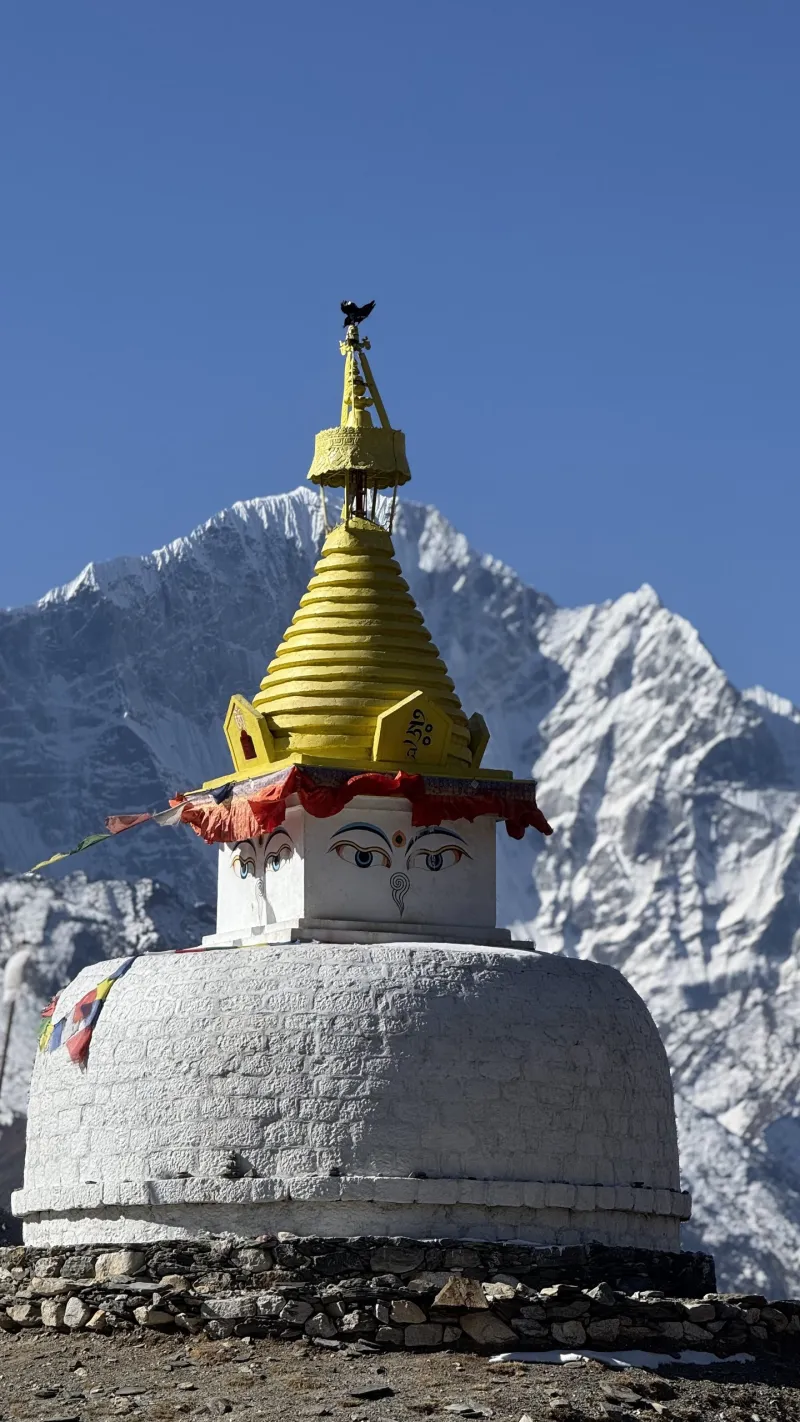
Always pass mani stones and chortens on their left (clockwise), per Buddhist custom.
Day 2

Phakding to Namche Bazaar

Day 2

Phakding to Namche Bazaar

Overnight: Namche Bazaar

Follow the Dudh Koshi upstream through Toktok and Benkar to Monjo, entering Sagarmatha National Park. After Jorsale, cross the high Hillary Suspension Bridge, then the relentless ~600 m 'Namche hill.' Namche is the Sherpa capital — a horseshoe-shaped amphitheater of lodges, bakeries, gear shops, and the trek's last reliable ATMs.

Day 2 of 18

Phakding to Namche Bazaar

Altitude: 2,610 m → 3,440 m (+830 m)
Time: ~10–11 km, 6–7 hours
Overnight: Namche Bazaar

Follow the Dudh Koshi upstream through Toktok and Benkar to Monjo, entering Sagarmatha National Park. After Jorsale, cross the high Hillary Suspension Bridge, then the relentless ~600 m 'Namche hill.' Namche is the Sherpa capital — a horseshoe-shaped amphitheater of lodges, bakeries, gear shops, and the trek's last reliable ATMs.

Go slowly on the Namche hill — pushing hard here is the classic way to start altitude trouble early.

Day 3

Acclimatization day in Namche

Day 3 Acclimatization

Acclimatization day in Namche

Overnight: Namche Bazaar

Hike high, sleep low: climb 300–450 m and return to Namche. Option 1 is the Everest View Hotel (3,880 m) via the Syangboche airstrip; Option 2 is quieter Khumjung village (3,790 m), with the Hillary School and monastery. Back in Namche: the Sherpa Culture Museum and stocking up on snacks and batteries.

Day 3 of 18

Acclimatization day in Namche

Time: 3–4 hour hike
Overnight: Namche Bazaar

Hike high, sleep low: climb 300–450 m and return to Namche. Option 1 is the Everest View Hotel (3,880 m) via the Syangboche airstrip; Option 2 is quieter Khumjung village (3,790 m), with the Hillary School and monastery. Back in Namche: the Sherpa Culture Museum and stocking up on snacks and batteries.

Day 4

Namche to Tengboche

Day 4

Namche to Tengboche

Overnight: Tengboche

A spectacular balcony trail contours high above the Dudh Koshi with constant views of Ama Dablam, Everest, and Lhotse, then drops to the river at Phunki Tenga (3,250 m) before a sustained ~600 m climb to the Tengboche ridge. Tengboche Monastery is the spiritual heart of Khumbu; arrive by around 3 pm for the afternoon prayer ceremony.

Day 4 of 18

Namche to Tengboche

Altitude: 3,440 m → 3,860 m (+420 m net, ~700 m of climbing)
Time: ~10 km, 5–6 hours
Overnight: Tengboche

A spectacular balcony trail contours high above the Dudh Koshi with constant views of Ama Dablam, Everest, and Lhotse, then drops to the river at Phunki Tenga (3,250 m) before a sustained ~600 m climb to the Tengboche ridge. Tengboche Monastery is the spiritual heart of Khumbu; arrive by around 3 pm for the afternoon prayer ceremony.

Day 5

Tengboche to Dingboche

Day 5

Tengboche to Dingboche

Overnight: Dingboche

Descend through forest to Deboche, cross the Imja Khola gorge, and climb to Pangboche (3,930 m), home to the oldest monastery in the region. Beyond Somare the trees disappear — true alpine terrain — and the trail forks up the Imja Valley to Dingboche.

Day 5 of 18

Tengboche to Dingboche

Altitude: 3,860 m → 4,410 m (+550 m)
Time: ~10–11 km, 5–6 hours
Overnight: Dingboche

Descend through forest to Deboche, cross the Imja Khola gorge, and climb to Pangboche (3,930 m), home to the oldest monastery in the region. Beyond Somare the trees disappear — true alpine terrain — and the trail forks up the Imja Valley to Dingboche.

Nights get seriously cold from here — ask for a hot water bottle for your sleeping bag.

Day 6

Acclimatization day in Dingboche

Day 6 Acclimatization

Acclimatization day in Dingboche

Overnight: Dingboche

One of the best acclimatization hikes in Nepal: Makalu to the east, Ama Dablam's north face, Island Peak, and the entire Imja Valley from the ridge above Dingboche. Go as high as feels comfortable.

Day 6 of 18

Acclimatization day in Dingboche

Altitude: Nangkartshang Peak (5,083 m), ~670 m ascent
Time: 3–4 hours round trip
Overnight: Dingboche

One of the best acclimatization hikes in Nepal: Makalu to the east, Ama Dablam's north face, Island Peak, and the entire Imja Valley from the ridge above Dingboche. Go as high as feels comfortable.

Day 7

Dingboche to Chhukung

Day 7

Dingboche to Chhukung

Overnight: Chhukung

A short, gentle walk up the Imja Valley beneath the colossal fluted ice walls of the Lhotse–Nuptse ridge. Arrive by lunch, then use the afternoon to hike partway up Chhukung Ri (5,550 m) to boost acclimatization for tomorrow's pass.

Day 7 of 18

Dingboche to Chhukung

Altitude: 4,410 m → 4,730 m (+320 m)
Time: ~4–5 km, about 3 hours
Overnight: Chhukung

A short, gentle walk up the Imja Valley beneath the colossal fluted ice walls of the Lhotse–Nuptse ridge. Arrive by lunch, then use the afternoon to hike partway up Chhukung Ri (5,550 m) to boost acclimatization for tomorrow's pass.

Go to bed early, pack the night before, and pre-order breakfast for around 4:00–4:30 am.

Day 8

Cross Kongma La to Lobuche — hardest day

Day 8

Cross Kongma La to Lobuche — hardest day

Overnight: Lobuche

No teahouses, food, or water sources between Chhukung and Lobuche — carry 2–3 liters and a full day of snacks. The trail climbs steadily over moraine and boulder slopes to Kongma La — the highest of the three passes — rewarded by prayer flags and a panorama of Makalu, Ama Dablam, and the Lobuche peaks. The descent crosses the rubble-covered Khumbu Glacier, its trail shifting constantly; follow cairns and expect 45–90 minutes of undulating scrambling before Lobuche.

Day 8 of 18

Cross Kongma La to Lobuche — hardest day

Altitude: 4,730 m → 5,535 m → 4,910 m
Time: ~10–11 km, 8–10 hours
Overnight: Lobuche

No teahouses, food, or water sources between Chhukung and Lobuche — carry 2–3 liters and a full day of snacks. The trail climbs steadily over moraine and boulder slopes to Kongma La — the highest of the three passes — rewarded by prayer flags and a panorama of Makalu, Ama Dablam, and the Lobuche peaks. The descent crosses the rubble-covered Khumbu Glacier, its trail shifting constantly; follow cairns and expect 45–90 minutes of undulating scrambling before Lobuche.

Bail-out option: if weather or health is bad, skip the pass by returning to Dingboche and walking the standard trail to Lobuche via Thukla. Start by 5:00 am.

Day 9

Lobuche to Everest Base Camp, return to Gorak Shep

Day 9

Lobuche to Everest Base Camp, return to Gorak Shep

Overnight: Gorak Shep

Follow the moraine crest beside the Khumbu Glacier to Gorak Shep, drop your bag, eat lunch, and continue to Everest Base Camp across rocky glacier terrain. The famous EBC boulder marks the spot; views of the Khumbu Icefall are the highlight — Everest's summit itself is hidden from Base Camp.

Day 9 of 18

Lobuche to Everest Base Camp, return to Gorak Shep

Altitude: 4,910 m → Gorak Shep 5,164 m → EBC 5,364 m → back to Gorak Shep
Time: ~12–13 km total, 7–8 hours
Overnight: Gorak Shep

Follow the moraine crest beside the Khumbu Glacier to Gorak Shep, drop your bag, eat lunch, and continue to Everest Base Camp across rocky glacier terrain. The famous EBC boulder marks the spot; views of the Khumbu Icefall are the highlight — Everest's summit itself is hidden from Base Camp.

This is your highest sleeping point of the trek — headaches and poor sleep are common; take it seriously if symptoms worsen.

Day 10

Kala Patthar sunrise, trek to Dzongla

Day 10

Kala Patthar sunrise, trek to Dzongla

Overnight: Dzongla

Kala Patthar is the Everest viewpoint of the trek: the full southwest face glowing gold at dawn, with Nuptse, the Khumbu Glacier, and Pumori right overhead. Descend for a late breakfast at Gorak Shep, then retrace to Lobuche and branch southwest on a high traverse beneath Cholatse and Taboche to Dzongla.

Day 10 of 18

Kala Patthar sunrise, trek to Dzongla

Altitude: 5,164 m → Kala Patthar 5,545 m → Dzongla 4,830 m
Time: 7–8 hours total
Overnight: Dzongla

Kala Patthar is the Everest viewpoint of the trek: the full southwest face glowing gold at dawn, with Nuptse, the Khumbu Glacier, and Pumori right overhead. Descend for a late breakfast at Gorak Shep, then retrace to Lobuche and branch southwest on a high traverse beneath Cholatse and Taboche to Dzongla.

Start around 4:00–5:00 am for sunrise; expect well below −10 °C. Pace yourself — Cho La comes tomorrow.

Day 11

Cross Cho La to Thagnak

Day 11

Cross Cho La to Thagnak

Overnight: Thagnak

The trail crosses a valley basin, then climbs steeply over rock slabs and boulders — some light scrambling required, sections can be icy. The top of the pass holds a glacier crossing, usually straightforward but slippery. The west-side descent is a steep rocky gully, then long boulder fields down to Thagnak at the edge of the Ngozumpa Glacier.

Day 11 of 18

Cross Cho La to Thagnak

Altitude: 4,830 m → 5,420 m → 4,700 m
Time: ~8–9 km, 7–9 hours
Overnight: Thagnak

The trail crosses a valley basin, then climbs steeply over rock slabs and boulders — some light scrambling required, sections can be icy. The top of the pass holds a glacier crossing, usually straightforward but slippery. The west-side descent is a steep rocky gully, then long boulder fields down to Thagnak at the edge of the Ngozumpa Glacier.

Start by 5:00–6:00 am — afternoon wind and cloud make the pass dangerous. Microspikes are strongly recommended.

Day 12

Thagnak to Gokyo

Day 12

Thagnak to Gokyo

Overnight: Gokyo

A short but fascinating day: cross the Ngozumpa Glacier, Nepal's longest, on a cairned trail through gray moraine hills and past turquoise melt-ponds, then arrive at Gokyo village on the shore of the brilliant blue third lake beneath Cho Oyu. Gokyo's bakeries are legendary after three hard days.

Day 12 of 18

Thagnak to Gokyo

Altitude: 4,700 m → 4,790 m
Time: ~4 km, 3–4 hours
Overnight: Gokyo

A short but fascinating day: cross the Ngozumpa Glacier, Nepal's longest, on a cairned trail through gray moraine hills and past turquoise melt-ponds, then arrive at Gokyo village on the shore of the brilliant blue third lake beneath Cho Oyu. Gokyo's bakeries are legendary after three hard days.

Day 13

Gokyo Ri, rest in Gokyo

Day 13

Gokyo Ri, rest in Gokyo

Overnight: Gokyo

Climb the steep switchbacks above the lake, ideally for sunrise. The summit panorama is arguably the best in the Khumbu: four 8,000 m peaks — Everest, Lhotse, Makalu, and Cho Oyu — plus the Ngozumpa Glacier and the string of lakes below. Afternoon options: rest, or walk to the fourth and fifth lakes for a quieter Everest viewpoint.

Day 13 of 18

Gokyo Ri, rest in Gokyo

Altitude: Gokyo Ri (5,357 m), ~570 m ascent
Time: 3–4 hours round trip
Overnight: Gokyo

Climb the steep switchbacks above the lake, ideally for sunrise. The summit panorama is arguably the best in the Khumbu: four 8,000 m peaks — Everest, Lhotse, Makalu, and Cho Oyu — plus the Ngozumpa Glacier and the string of lakes below. Afternoon options: rest, or walk to the fourth and fifth lakes for a quieter Everest viewpoint.

Early night — one pass to go.

Day 14

Cross Renjo La to Lungden

Day 14

Cross Renjo La to Lungden

Overnight: Lungden

The trail rounds Gokyo lake and climbs steadily to Renjo La — the reward at the top is the trek's single most photographed view: Gokyo's turquoise lake and village directly below, with Everest, Lhotse, and Makalu lined up behind. The descent is a long, knee-testing stone staircase into the wide, wild Nakpa Valley to tiny, quiet Lungden.

Day 14 of 18

Cross Renjo La to Lungden

Altitude: 4,790 m → 5,360 m → 4,380 m
Time: ~10 km, 7–8 hours
Overnight: Lungden

The trail rounds Gokyo lake and climbs steadily to Renjo La — the reward at the top is the trek's single most photographed view: Gokyo's turquoise lake and village directly below, with Everest, Lhotse, and Makalu lined up behind. The descent is a long, knee-testing stone staircase into the wide, wild Nakpa Valley to tiny, quiet Lungden.

Start around 6:00 am. Savor the summit — this is the last pass.

Day 15

Lungden to Thame

Day 15

Lungden to Thame

Overnight: Thame

A gentle, gorgeous descent down the Nakpa Valley through the yak-herding hamlets of Marulung and Taranga. Thame is one of Khumbu's most historic Sherpa villages — home to legendary climbers including Apa Sherpa and Kami Rita Sherpa, and where Tenzing Norgay spent part of his youth. Visit Thame Monastery, perched above the village.

Day 15 of 18

Lungden to Thame

Altitude: 4,380 m → 3,820 m (−560 m)
Time: ~9–10 km, 4–5 hours
Overnight: Thame

A gentle, gorgeous descent down the Nakpa Valley through the yak-herding hamlets of Marulung and Taranga. Thame is one of Khumbu's most historic Sherpa villages — home to legendary climbers including Apa Sherpa and Kami Rita Sherpa, and where Tenzing Norgay spent part of his youth. Visit Thame Monastery, perched above the village.

Day 16

Thame to Namche Bazaar

Day 16

Thame to Namche Bazaar

Overnight: Namche Bazaar

An easy, scenic valley walk along the Bhote Koshi through Thamo, passing long mani walls and a small hydroelectric plant, rejoining the main trail just above Namche. Arrive by lunch — time for a hot shower, fresh bakery goods, and the Saturday market.

Day 16 of 18

Thame to Namche Bazaar

Altitude: 3,820 m → 3,440 m
Time: ~9 km, 4–5 hours
Overnight: Namche Bazaar

An easy, scenic valley walk along the Bhote Koshi through Thamo, passing long mani walls and a small hydroelectric plant, rejoining the main trail just above Namche. Arrive by lunch — time for a hot shower, fresh bakery goods, and the Saturday market.

Day 17

Namche to Lukla

Day 17

Namche to Lukla

Overnight: Lukla

The longest distance day, but mostly downhill: the big descent off the Namche hill, back across the Hillary Bridge, through Monjo and Phakding, finishing with the sneaky final climb into Lukla.

Day 17 of 18

Namche to Lukla

Altitude: 3,440 m → 2,860 m
Time: ~18–19 km, 6–7 hours
Overnight: Lukla

The longest distance day, but mostly downhill: the big descent off the Namche hill, back across the Hillary Bridge, through Monjo and Phakding, finishing with the sneaky final climb into Lukla.

Reconfirm your flight with your lodge or airline office the evening you arrive.

Day 18

Fly Lukla to Kathmandu

Day 18

Fly Lukla to Kathmandu

Morning flights are far more reliable — afternoon departures are frequently cancelled as clouds build. In peak season you will likely land at Ramechhap and drive 4–5 hours back to Kathmandu. Budget a celebratory dinner in Thamel.

Day 18 of 18

Fly Lukla to Kathmandu

Morning flights are far more reliable — afternoon departures are frequently cancelled as clouds build. In peak season you will likely land at Ramechhap and drive 4–5 hours back to Kathmandu. Budget a celebratory dinner in Thamel.

Essential Gear

  • Microspikes — essential for Cho La, useful on all three passes
  • Sleeping bag rated to −15 °C or colder
  • Trekking poles — the pass descents punish knees
  • Water purification tablets or filter
  • Category 3–4 sunglasses, sunscreen, and lip balm — glacier glare is intense
  • Headlamp with spare batteries — all pass days start in the dark

Good to Know

  • This is Genesis's most demanding standard Everest itinerary — recommended for trekkers with prior high-altitude trekking experience, not a first Himalayan trek.
  • Know the symptoms of acute mountain sickness (headache, nausea, dizziness, poor sleep). Never ascend with worsening symptoms — descending is the cure. Consider carrying Diamox after consulting a doctor.
  • Get travel insurance that explicitly covers trekking above 5,500 m and helicopter evacuation.
  • Check the weather before each pass day; fresh snow can close any of the passes. All three have valley bail-out routes.
  • Strongly consider adding 1–2 buffer days to this schedule for weather delays at Lukla or the passes.
  • No ATMs beyond Namche; budget roughly NPR 4,000–6,000 per day for food and lodging up high.
  • Typical daily rhythm: wake 6–7 am (4–5 am on pass days), breakfast, walk with a tea or lunch stop, arrive early-to-mid afternoon, hydrate and rest, order dinner by around 6 pm, sleep by 8–9 pm.

Ready to trek Everest Three Passes Trek?

Talk to a specialist who has personally trekked every route we sell — no call center, no script.

Call / WhatsApp Plan My Trek