Skip to content

Gokyo Lakes Trek

Turquoise lakes, the Ngozumpa Glacier, and one of the best Everest panoramas in Nepal — quieter than the classic Base Camp trail.

12 Days / 11 Nights Challenging Gokyo Ri (5,357 m) Khumbu Region, Nepal
Starting from $1,550 per person

Overview

The Gokyo Lakes Trek is a 12-day route through the Khumbu region that trades some of the crowds of the Everest Base Camp trail for the finest lake and glacier scenery in the area and one of the best Everest panoramas in Nepal. The trek climbs from Lukla through Namche Bazaar and up the Dudh Koshi valley to the turquoise Gokyo lakes, beneath Cho Oyu, before a pre-dawn ascent of Gokyo Ri (5,357 m) for views of four 8,000 m peaks — Everest, Lhotse, Makalu, and Cho Oyu.

This itinerary adds a Day 8 excursion to the 4th and 5th lakes and Scoundrel's Viewpoint (the trek's hidden highlight and a built-in weather buffer), routes the return descent through Dole instead of Machhermo for a more comfortable, gentler pace, and flags the Day 4 Namche-to-Dole stage — a 670 m sleeping-altitude gain, the biggest of the trek — pairing it with a short following day and an acclimatization hike.

Highlights

  • Gokyo Ri (5,357 m) sunrise over four 8,000 m peaks: Everest, Lhotse, Makalu, and Cho Oyu
  • The turquoise Gokyo Lakes, including Dudh Pokhari beneath Cho Oyu
  • Ngozumpa Glacier, Nepal's longest glacier
  • 4th and 5th lakes and Scoundrel's Viewpoint — a head-on view of Everest's southwest face with a fraction of the crowds
  • Sherpa capital of Namche Bazaar and Khumjung village
  • Quieter alternative to the Everest Base Camp trail with comparable Everest views

The Shape of the Trek

Sleep altitude each night — the acclimatization pattern at a glance.

2,500 3,000 3,500 4,000 4,500 5,000 4,790 m Day 1 Day 11
2,610 m · Day 1 · Phakding
3,440 m · Day 2 · Namche Bazaar
3,440 m · Day 3 · Namche Bazaar
4,110 m · Day 4 · Dole
4,470 m · Day 5 · Machhermo
4,790 m · Day 6 · Gokyo
4,790 m · Day 7 · Gokyo
4,790 m · Day 8 · Gokyo
4,110 m · Day 9 · Dole
3,440 m · Day 10 · Namche Bazaar
2,860 m · Day 11 · Lukla

Departure Dates

No scheduled dates for this trek yet — we run it on the dates that suit you. If you’re planning a trek for a group of friends or family, talk to our specialist and we’ll build it around you.

Talk to our specialist

The route

Route Map

6 stops · 1 flight · 7 trekking sections

NEPALPhakdingSTARTNamche BazaarDoleMachhermoGokyoDoleNamche BazaarLuklaEND
By air On foot

Day-by-Day Itinerary

12 days on the trail, mapped one by one — no need to expand anything.

Day of 12

Day 1

Fly Kathmandu to Lukla, trek to Phakding

Day 1

Fly Kathmandu to Lukla, trek to Phakding

Overnight: Phakding

An easy warm-up day. After a ~30–35 minute flight to Tenzing-Hillary Airport (in peak season most flights operate from Ramechhap/Manthali, a 4–5 hour pre-dawn drive from Kathmandu), the trail descends out of Lukla through Chheplung and Ghat, following the Dudh Koshi river past mani walls, prayer wheels, and the first suspension bridges. Arrive in Phakding by early afternoon and rest.

Day 1 of 12

Fly Kathmandu to Lukla, trek to Phakding

Altitude: Lukla 2,860 m → Phakding 2,610 m (net descent ~250 m)
Time: ~8 km, 3–4 hours
Overnight: Phakding

An easy warm-up day. After a ~30–35 minute flight to Tenzing-Hillary Airport (in peak season most flights operate from Ramechhap/Manthali, a 4–5 hour pre-dawn drive from Kathmandu), the trail descends out of Lukla through Chheplung and Ghat, following the Dudh Koshi river past mani walls, prayer wheels, and the first suspension bridges. Arrive in Phakding by early afternoon and rest.

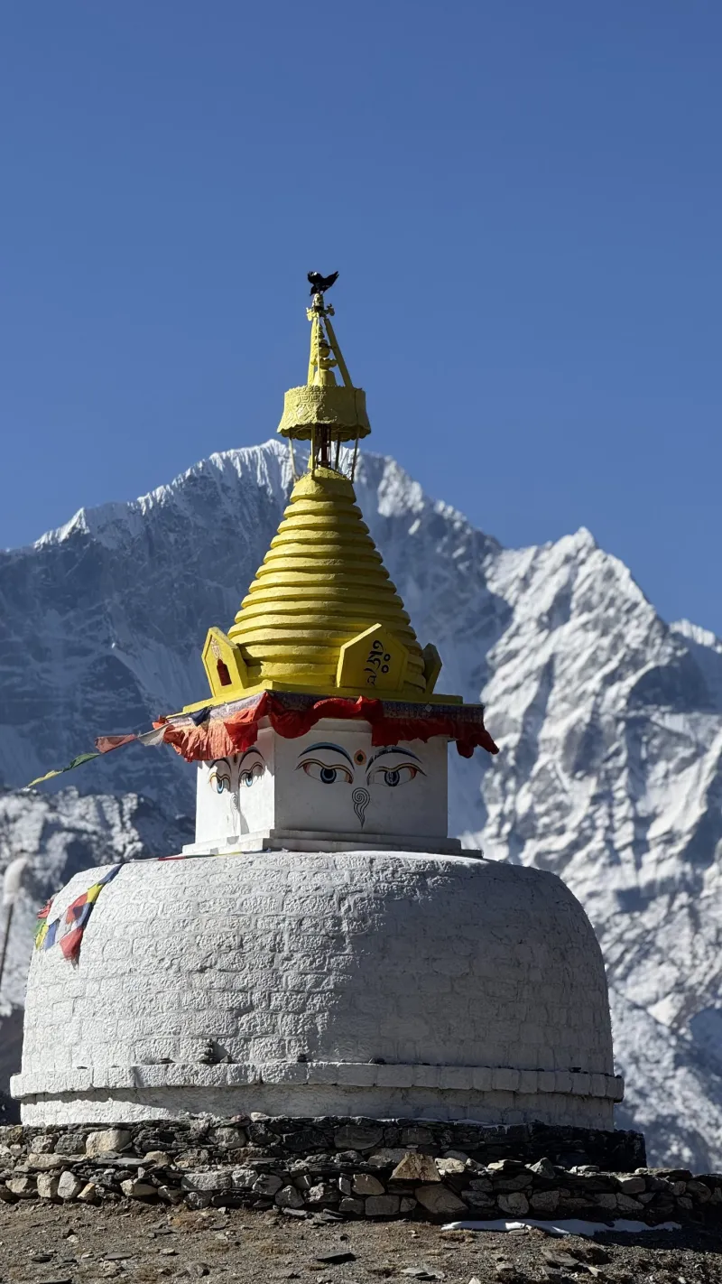
Always pass mani stones and chortens on their left (clockwise), per Buddhist custom.
Day 2

Phakding to Namche Bazaar

Day 2

Phakding to Namche Bazaar

Overnight: Namche Bazaar

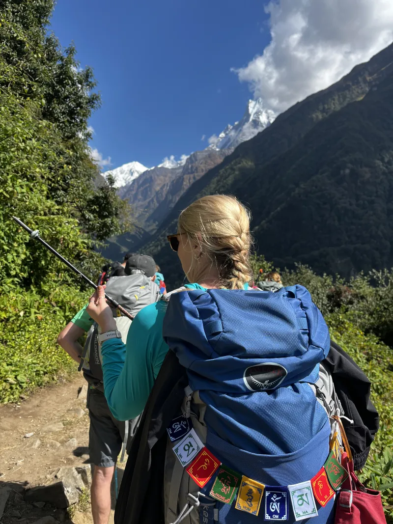
Follow the Dudh Koshi upstream through Toktok and Benkar to Monjo, where you enter Sagarmatha National Park. After Jorsale, cross the high Hillary Suspension Bridge and begin the relentless ~600 m 'Namche hill'; about halfway up, a clearing offers the first glimpse of Everest on a clear day. Namche Bazaar is the Sherpa capital, with lodges, bakeries, gear shops, and the last reliable ATMs of the trek.

Day 2 of 12

Phakding to Namche Bazaar

Altitude: 2,610 m → 3,440 m (+830 m)
Time: ~10–11 km, 6–7 hours
Overnight: Namche Bazaar

Follow the Dudh Koshi upstream through Toktok and Benkar to Monjo, where you enter Sagarmatha National Park. After Jorsale, cross the high Hillary Suspension Bridge and begin the relentless ~600 m 'Namche hill'; about halfway up, a clearing offers the first glimpse of Everest on a clear day. Namche Bazaar is the Sherpa capital, with lodges, bakeries, gear shops, and the last reliable ATMs of the trek.

Go slowly on the Namche hill; pushing hard here is the classic way to start altitude trouble early.

Day 3

Acclimatization day in Namche

Day 3 Acclimatization

Acclimatization day in Namche

Overnight: Namche Bazaar

Hike high, sleep low: climb 300–450 m and return to Namche for the night. Option 1 is the Everest View Hotel (3,880 m), 1.5–2 hours up via the Syangboche airstrip, with terrace views of Everest, Lhotse, and Ama Dablam over tea; Option 2 is quieter Khumjung village (3,790 m), with the Hillary School and Khumjung monastery. Back in Namche, visit the Sherpa Culture Museum and stock up on snacks and batteries.

Day 3 of 12

Acclimatization day in Namche

Altitude: 3,440 m (day hike to 3,790–3,880 m)
Time: 3–4 hour hike
Overnight: Namche Bazaar

Hike high, sleep low: climb 300–450 m and return to Namche for the night. Option 1 is the Everest View Hotel (3,880 m), 1.5–2 hours up via the Syangboche airstrip, with terrace views of Everest, Lhotse, and Ama Dablam over tea; Option 2 is quieter Khumjung village (3,790 m), with the Hillary School and Khumjung monastery. Back in Namche, visit the Sherpa Culture Museum and stock up on snacks and batteries.

This rest day matters — the next day brings the biggest sleeping-altitude gain of the trek.

Day 4

Namche to Dole

Day 4

Namche to Dole

Namche → Mong La → Phortse Tanga → Dole

Overnight: Dole

Leave the main Everest Base Camp trail behind: from Kyangjuma the route climbs to the chorten at Mong La (3,975 m), a superb viewpoint over Ama Dablam and the Dudh Koshi valley. A steep descent drops to the river at Phortse Tanga (3,680 m) — a good lunch stop — before a long climb through rhododendron and birch forest to Dole, a small cluster of lodges above the treeline. Keep an eye out for Himalayan tahr and musk deer in the forest, one of the best wildlife sections in Khumbu.

Day 4 of 12

Namche to Dole

Namche → Mong La → Phortse Tanga → Dole

Altitude: 3,440 m → 4,110 m (+670 m — the biggest sleeping gain of the trek)
Time: ~11 km, 5–6 hours
Overnight: Dole

Leave the main Everest Base Camp trail behind: from Kyangjuma the route climbs to the chorten at Mong La (3,975 m), a superb viewpoint over Ama Dablam and the Dudh Koshi valley. A steep descent drops to the river at Phortse Tanga (3,680 m) — a good lunch stop — before a long climb through rhododendron and birch forest to Dole, a small cluster of lodges above the treeline. Keep an eye out for Himalayan tahr and musk deer in the forest, one of the best wildlife sections in Khumbu.

Walk deliberately slowly after Phortse Tanga and hydrate well — a 670 m gain in one day is right at the recommended limit.

Day 5

Dole to Machhermo

Day 5

Dole to Machhermo

Overnight: Machhermo

A deliberately short day to aid acclimatization. The trail climbs steadily along the west side of the Dudh Koshi valley, through the summer herding settlements of Lhabarma and Luza, as Cho Oyu begins to dominate the head of the valley. In the afternoon, an optional acclimatization hike climbs the ridge above the village for views of Cho Oyu, Thamserku, and Kangtega. Machhermo hosts an IPPG altitude rescue post, which gives a free daily talk on altitude sickness in season.

Day 5 of 12

Dole to Machhermo

Altitude: 4,110 m → 4,470 m (+360 m)
Time: ~5–6 km, 4–5 hours
Overnight: Machhermo

A deliberately short day to aid acclimatization. The trail climbs steadily along the west side of the Dudh Koshi valley, through the summer herding settlements of Lhabarma and Luza, as Cho Oyu begins to dominate the head of the valley. In the afternoon, an optional acclimatization hike climbs the ridge above the village for views of Cho Oyu, Thamserku, and Kangtega. Machhermo hosts an IPPG altitude rescue post, which gives a free daily talk on altitude sickness in season.

Attend the free altitude talk at the Machhermo rescue post if it is running.

Day 6

Machhermo to Gokyo, past the lakes

Day 6

Machhermo to Gokyo, past the lakes

Overnight: Gokyo

Climb past Pangka, then up a steep, rocky section alongside the terminal moraine of the Ngozumpa Glacier, Nepal's longest. The trail levels out and the lakes begin: first Longpongo (4,690 m), then the vivid Taboche Tsho, and finally the third and largest lake, Dudh Pokhari, with Gokyo village on its shore beneath Cho Oyu. Arrive by early afternoon to stroll the lakeshore and rest ahead of tomorrow's pre-dawn climb.

Day 6 of 12

Machhermo to Gokyo, past the lakes

Altitude: 4,470 m → 4,790 m (+320 m)
Time: ~5–6 km, 4–5 hours
Overnight: Gokyo

Climb past Pangka, then up a steep, rocky section alongside the terminal moraine of the Ngozumpa Glacier, Nepal's longest. The trail levels out and the lakes begin: first Longpongo (4,690 m), then the vivid Taboche Tsho, and finally the third and largest lake, Dudh Pokhari, with Gokyo village on its shore beneath Cho Oyu. Arrive by early afternoon to stroll the lakeshore and rest ahead of tomorrow's pre-dawn climb.

Day 7

Gokyo Ri sunrise, rest in Gokyo

Day 7

Gokyo Ri sunrise, rest in Gokyo

Overnight: Gokyo

Starting around 4:00–5:00 am, climb the steep switchbacks above the lake in the dark to watch dawn break over one of the finest panoramas in the Himalaya: four 8,000 m peaks — Everest, Lhotse, Makalu, and Cho Oyu — with the Ngozumpa Glacier and the string of turquoise lakes below. Descend for a late breakfast, then take the afternoon completely off to nap, read, walk the lake, and eat well.

Day 7 of 12

Gokyo Ri sunrise, rest in Gokyo

Altitude: Gokyo Ri (5,357 m), ~570 m ascent
Time: 3–4 hours round trip
Overnight: Gokyo

Starting around 4:00–5:00 am, climb the steep switchbacks above the lake in the dark to watch dawn break over one of the finest panoramas in the Himalaya: four 8,000 m peaks — Everest, Lhotse, Makalu, and Cho Oyu — with the Ngozumpa Glacier and the string of turquoise lakes below. Descend for a late breakfast, then take the afternoon completely off to nap, read, walk the lake, and eat well.

Dress very warmly for the pre-dawn start.

Day 8

Day trip to the 4th and 5th lakes

Day 8

Day trip to the 4th and 5th lakes

Gokyo → Thonak Tsho → Ngozumpa Tsho → Scoundrel's Viewpoint → Gokyo

Overnight: Gokyo

A recommended addition and the trek's hidden gem, missed by most trekkers. Walk north along the glacier's edge to the fourth lake, Thonak Tsho (4,830 m), then continue to the fifth, Ngozumpa Tsho (4,990 m); from the small rise behind it, Scoundrel's Viewpoint, there is a closer, head-on view of Everest's southwest face and the full length of the Ngozumpa Glacier with a fraction of Gokyo Ri's crowds. Carry lunch, water, and warm layers, and turn around by early afternoon.

Day 8 of 12

Day trip to the 4th and 5th lakes

Gokyo → Thonak Tsho → Ngozumpa Tsho → Scoundrel's Viewpoint → Gokyo

Altitude: high point ~5,000 m at Scoundrel's Viewpoint
Time: ~10–12 km round trip, 5–6 hours
Overnight: Gokyo

A recommended addition and the trek's hidden gem, missed by most trekkers. Walk north along the glacier's edge to the fourth lake, Thonak Tsho (4,830 m), then continue to the fifth, Ngozumpa Tsho (4,990 m); from the small rise behind it, Scoundrel's Viewpoint, there is a closer, head-on view of Everest's southwest face and the full length of the Ngozumpa Glacier with a fraction of Gokyo Ri's crowds. Carry lunch, water, and warm layers, and turn around by early afternoon.

This day also serves as your built-in buffer for Lukla flight delays or bad weather.

Day 9

Gokyo to Dole

Day 9

Gokyo to Dole

Overnight: Dole

Retrace the trail down past the lakes, the moraine staircase, and Machhermo. Going downhill with thickening air, continuing to Dole keeps the following stage reasonable and gives a far better night's sleep 700 m lower. Appetite comes roaring back around this altitude.

Day 9 of 12

Gokyo to Dole

Altitude: 4,790 m → 4,110 m (−680 m)
Time: ~10–11 km, 5–6 hours
Overnight: Dole

Retrace the trail down past the lakes, the moraine staircase, and Machhermo. Going downhill with thickening air, continuing to Dole keeps the following stage reasonable and gives a far better night's sleep 700 m lower. Appetite comes roaring back around this altitude.

Day 10

Dole to Namche Bazaar

Day 10

Dole to Namche Bazaar

Dole → Phortse Tanga → Mong La → Kyangjuma → Namche

Overnight: Namche Bazaar

Descend through the forest to Phortse Tanga, then tackle the last real climb of the trek back up to Mong La for a final view of Ama Dablam. From there it is a gentle contour back to Kyangjuma and into Namche by mid-afternoon — time to celebrate with a hot shower, bakery goods, and a browse of the gear shops.

Day 10 of 12

Dole to Namche Bazaar

Dole → Phortse Tanga → Mong La → Kyangjuma → Namche

Altitude: 4,110 m → 3,440 m
Time: ~11 km, 5–6 hours
Overnight: Namche Bazaar

Descend through the forest to Phortse Tanga, then tackle the last real climb of the trek back up to Mong La for a final view of Ama Dablam. From there it is a gentle contour back to Kyangjuma and into Namche by mid-afternoon — time to celebrate with a hot shower, bakery goods, and a browse of the gear shops.

Day 11

Namche to Lukla

Day 11

Namche to Lukla

Overnight: Lukla

The longest distance day of the trek, but mostly downhill: the big descent off the Namche hill, back across the Hillary Bridge, through Monjo and Phakding, finishing with a short, sneaky climb up into Lukla.

Day 11 of 12

Namche to Lukla

Altitude: 3,440 m → 2,860 m
Time: ~18–19 km, 6–7 hours
Overnight: Lukla

The longest distance day of the trek, but mostly downhill: the big descent off the Namche hill, back across the Hillary Bridge, through Monjo and Phakding, finishing with a short, sneaky climb up into Lukla.

Reconfirm your flight with your lodge or airline office the evening you arrive.

Day 12

Fly Lukla to Kathmandu

Day 12

Fly Lukla to Kathmandu

Morning flights are far more reliable — afternoon departures are frequently cancelled as clouds build. In peak season you will likely land at Ramechhap and drive 4–5 hours back to Kathmandu. Budget a celebratory dinner in Thamel.

Day 12 of 12

Fly Lukla to Kathmandu

Morning flights are far more reliable — afternoon departures are frequently cancelled as clouds build. In peak season you will likely land at Ramechhap and drive 4–5 hours back to Kathmandu. Budget a celebratory dinner in Thamel.

Avoid booking an international flight the day after your planned return to Kathmandu.

Essential Gear

  • Sleeping bag rated to −10 °C or colder (Gokyo nights are frigid)
  • Trekking poles for the Mong La descents and moraine sections
  • Water purification tablets or filter
  • Category 3–4 sunglasses, sunscreen, lip balm — lake and glacier glare is intense
  • Headlamp with spare batteries for the Gokyo Ri pre-dawn start
  • Microspikes (cheap insurance in early spring or after snowfall)

Good to Know

  • Carry your passport and a few passport photos for permits.
  • October–November brings the clearest skies and the bluest lakes, with cold nights and busy trails as far as Namche (much quieter beyond Mong La).
  • March–May brings warmer days and rhododendron blooms low down, more afternoon cloud, and lakes that may still be partly frozen in early spring.
  • Monsoon (June–September) is not recommended; winter is possible for experienced, well-equipped trekkers but lodges up high may close.
  • Know the symptoms of acute mountain sickness (headache, nausea, dizziness, poor sleep); never ascend with worsening symptoms — descending is the cure.
  • Get travel insurance that explicitly covers trekking above 5,000 m and helicopter evacuation.
  • Optional extension: the Renjo La loop crosses Renjo La (5,360 m) from Gokyo and returns via Lungden and Thame, adding one day and a dramatic pass crossing.
  • Optional extension: strong, well-acclimatized trekkers can cross Cho La (5,420 m) eastward to join the Everest Base Camp trail, adding 3–4 days.
  • Typical daily rhythm: wake 6–7 am (4:30 am on Gokyo Ri day), breakfast, walk with a tea or lunch stop, arrive early-to-mid afternoon, hydrate and rest, order dinner by around 6 pm, sleep by 8–9 pm.

Ready to trek Gokyo Lakes Trek?

Talk to a specialist who has personally trekked every route we sell — no call center, no script.

Call / WhatsApp Plan My Trek