Skip to content
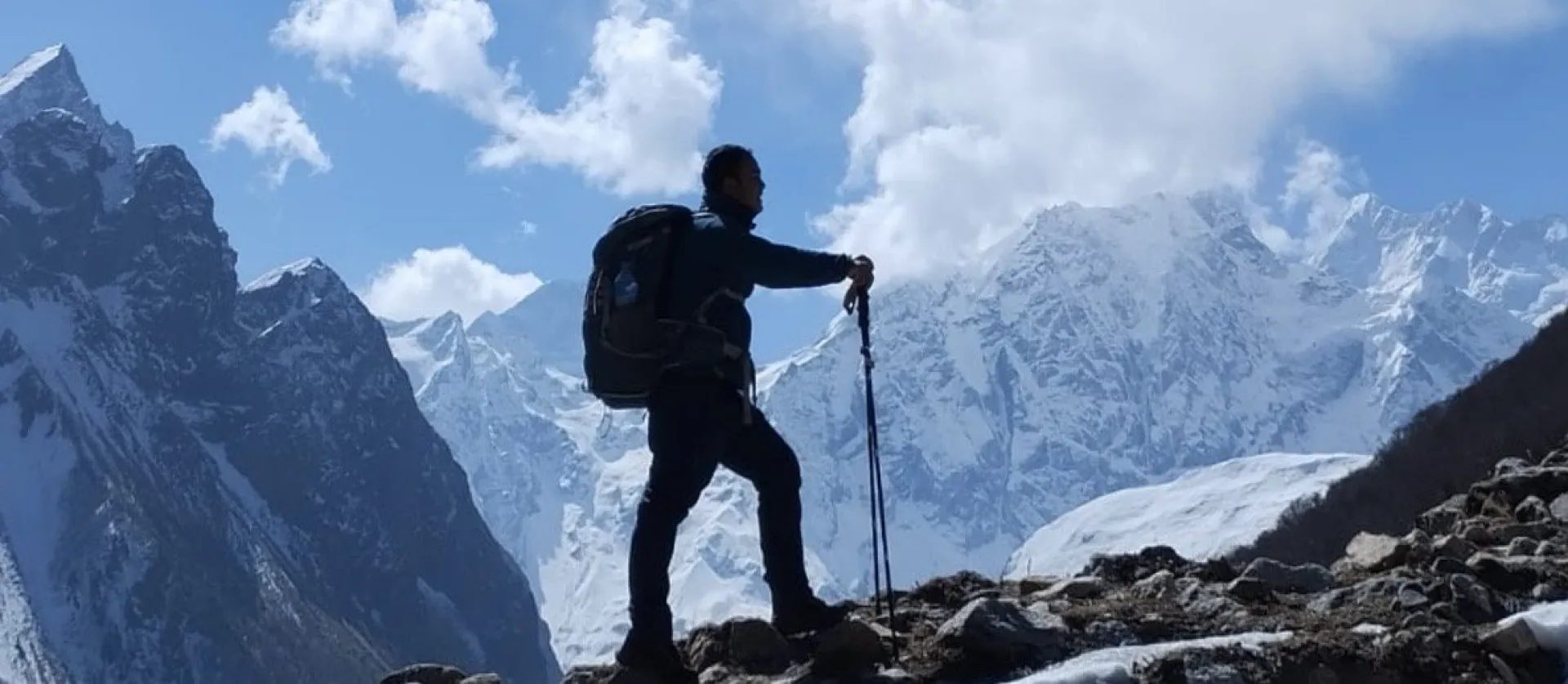
A trekker silhouetted against the snow-capped peaks of the Manaslu range

Manaslu Circuit Trek

A quieter, wilder horseshoe around the world's eighth-highest mountain, over the Larke La at 5,106 m.

13 Days / 12 Nights Strenuous 5,106 m (Larke La) Manaslu Region, Nepal
Starting from $1,450 per person

Overview

The Manaslu Circuit is the classic horseshoe around Mt. Manaslu (8,163 m), the world's eighth-highest mountain — a quieter, wilder alternative to the Annapurna Circuit through a restricted region of Tibetan Buddhist Nubri villages, climaxing in a single big pass day at the Larke La (5,106 m).

The route follows the Budhi Gandaki upriver from Machha Khola through a narrowing gorge to Jagat, the gateway to the restricted area, then on through Namrung, Lho, and Samagaun — the cultural heart of the Nubri valley, with Manaslu filling the sky directly overhead. An acclimatization day at Samagaun sets up the push over the Larke La to Bimthang, before a long descent through Nepal's finest rhododendron and pine forest to Dharapani, where the route joins the classic Annapurna Circuit trail for the drive out to Besisahar.

This itinerary follows the standard, well-paced village progression, with the acclimatization day correctly placed before the pass sequence. The one deliberate exception is the jump to Dharmasala before the pass itself, which exceeds the usual daily altitude-gain guideline — accepted practice here since the group crosses the pass and descends 1,400 m the very next day, with the firm rule that nobody with worsening symptoms sleeps at Dharmasala.

Highlights

  • A full circuit of Mt. Manaslu (8,163 m), the world's eighth-highest peak, through a restricted region most trekkers never reach
  • Tibetan Buddhist Nubri villages — Namrung, Lho, Samagaun — with mani walls, chortens, and a culture distinct from the Everest or Annapurna trails
  • Crossing the Larke La (5,106 m), the trek's single big pass day, with views of Himlung, Cheo Himal, Kang Guru, and Annapurna II
  • Manaslu Base Camp or Birendra Lake as an acclimatization option at Samagaun, directly beneath the mountain
  • Bimthang, a meadow amphitheater beneath Manaslu's west face, reached by the steep descent off the pass
  • One of Nepal's least-crowded major circuits — restricted-area rules cap numbers well below the Annapurna Circuit

Photos

TODO describe: Manaslu Circuit Trek

TODO describe: Manaslu Circuit Trek

TODO describe: Manaslu Circuit Trek

TODO describe: Manaslu Circuit Trek

TODO describe: Manaslu Circuit Trek

TODO describe: Manaslu Circuit Trek

TODO describe: Manaslu Circuit Trek

TODO describe: Manaslu Circuit Trek

TODO describe: Manaslu Circuit Trek

TODO describe: Manaslu Circuit Trek

TODO describe: Manaslu Circuit Trek

TODO describe: Manaslu Circuit Trek

TODO describe: Manaslu Circuit Trek

TODO describe: Manaslu Circuit Trek

TODO describe: Manaslu Circuit Trek

TODO describe: Manaslu Circuit Trek

TODO describe: Manaslu Circuit Trek

TODO describe: Manaslu Circuit Trek

TODO describe: Manaslu Circuit Trek

TODO describe: Manaslu Circuit Trek

TODO describe: Manaslu Circuit Trek

TODO describe: Manaslu Circuit Trek

TODO describe: Manaslu Circuit Trek

TODO describe: Manaslu Circuit Trek

TODO describe: Manaslu Circuit Trek

TODO describe: Manaslu Circuit Trek

TODO describe: Manaslu Circuit Trek

TODO describe: Manaslu Circuit Trek

TODO describe: Manaslu Circuit Trek

TODO describe: Manaslu Circuit Trek

TODO describe: Manaslu Circuit Trek

TODO describe: Manaslu Circuit Trek

TODO describe: Manaslu Circuit Trek

TODO describe: Manaslu Circuit Trek

TODO describe: Manaslu Circuit Trek

TODO describe: Manaslu Circuit Trek

TODO describe: Manaslu Circuit Trek

TODO describe: Manaslu Circuit Trek

TODO describe: Manaslu Circuit Trek

The Shape of the Trek

Sleep altitude each night — the acclimatization pattern at a glance.

0 1,000 2,000 3,000 4,000 5,000 4,460 m Day 1 Day 13
930 m · Day 1 · Machha Khola
1,340 m · Day 2 · Jagat
1,860 m · Day 3 · Deng
2,630 m · Day 4 · Namrung
3,180 m · Day 5 · Lho
3,530 m · Day 6 · Samagaun
3,530 m · Day 7 · Samagaun
3,875 m · Day 8 · Samdo
4,460 m · Day 9 · Dharmasala
3,720 m · Day 10 · Bimthang
2,300 m · Day 11 · Tilije
760 m · Day 12 · Besisahar
1,400 m · Day 13 · Drive Besisahar to Kathmandu

Departure Dates

No scheduled dates for this trek yet — we run it on the dates that suit you. If you’re planning a trek for a group of friends or family, talk to our specialist and we’ll build it around you.

Talk to our specialist

The route

Route Map

9 stops · 7 trekking sections

NEPALMachha KholaSTARTJagatDengNamrungLhoSamdoDharmasalaBimthangBesisaharEND
By road On foot

Day-by-Day Itinerary

13 days on the trail, mapped one by one — no need to expand anything.

Day of 13

Day 1

Drive Kathmandu to Machha Khola

Day 1

Drive Kathmandu to Machha Khola

Kathmandu → Arughat → Soti Khola → Machha Khola

Overnight: Machha Khola (930 m)

A long, scenic drive west along the Prithvi Highway, then north up the Budhi Gandaki valley through Arughat and Soti Khola. The final hours run on a rough jeep track cut into the gorge, landslide-prone in and after the monsoon. Machha Khola ("fish river") is a small riverside bazaar with simple lodges.

Day 1 of 13

Drive Kathmandu to Machha Khola

Kathmandu → Arughat → Soti Khola → Machha Khola

Altitude: Kathmandu 1,400 m → Machha Khola 930 m
Time: 8–10 h drive
Overnight: Machha Khola (930 m)

A long, scenic drive west along the Prithvi Highway, then north up the Budhi Gandaki valley through Arughat and Soti Khola. The final hours run on a rough jeep track cut into the gorge, landslide-prone in and after the monsoon. Machha Khola ("fish river") is a small riverside bazaar with simple lodges.

Leave Kathmandu by 6–7 am — arriving in daylight matters on this road. A private jeep is strongly recommended over the local bus.

Day 2

Machha Khola to Jagat

Day 2

Machha Khola to Jagat

Machha Khola → Tatopani hot spring → Khorlabesi → Jagat

Overnight: Jagat (1,340 m)

The trail follows the roaring Budhi Gandaki through a hot, low-altitude gorge, crossing and re-crossing on long suspension bridges past the hot spring at Tatopani and the village of Khorlabesi, then climbs stone staircases carved into the cliffside to Jagat — a beautifully flagstoned Gurung village and the official gateway to the restricted area.

Day 2 of 13

Machha Khola to Jagat

Machha Khola → Tatopani hot spring → Khorlabesi → Jagat

Altitude: 930 m → 1,340 m (+410 m)
Time: 6–7 h
Overnight: Jagat (1,340 m)

The trail follows the roaring Budhi Gandaki through a hot, low-altitude gorge, crossing and re-crossing on long suspension bridges past the hot spring at Tatopani and the village of Khorlabesi, then climbs stone staircases carved into the cliffside to Jagat — a beautifully flagstoned Gurung village and the official gateway to the restricted area.

It is warm and humid down here — start early and drink constantly.

Day 3

Jagat to Deng

Day 3

Jagat to Deng

Jagat (permit checkpoint) → Salleri → Philim → Ekle Bhatti → Deng

Overnight: Deng (1,860 m)

Permits are checked and stamped at Jagat, the formal entry to the Manaslu restricted region. The gorge narrows dramatically — waterfalls streak the walls, the trail blasts through cliffs, and the villages of Salleri and Philim pass by. Beyond the confluence where the Tsum Valley trail branches east, the route crosses into pine forest and the small village of Deng, where the culture starts shifting from Hindu Gurung to Tibetan Buddhist.

Day 3 of 13

Jagat to Deng

Jagat (permit checkpoint) → Salleri → Philim → Ekle Bhatti → Deng

Altitude: 1,340 m → 1,860 m (+520 m)
Time: 6–7 h
Overnight: Deng (1,860 m)

Permits are checked and stamped at Jagat, the formal entry to the Manaslu restricted region. The gorge narrows dramatically — waterfalls streak the walls, the trail blasts through cliffs, and the villages of Salleri and Philim pass by. Beyond the confluence where the Tsum Valley trail branches east, the route crosses into pine forest and the small village of Deng, where the culture starts shifting from Hindu Gurung to Tibetan Buddhist.

Your guide registers permits at checkpoints from here on — keep your passport accessible.

Day 4

Deng to Namrung

Day 4

Deng to Namrung

Deng → Rana → Bihi Phedi → Ghap → Namrung

Overnight: Namrung (2,630 m)

A day of steady climbing through some of the trek's most dramatic gorge scenery — the trail switchbacks high above the river past Rana, Bihi Phedi, and Ghap, with mani walls, chortens, and carved prayer stones appearing everywhere now. The final forested climb delivers the first big mountain views: Siring Himal and the Ganesh Himal range.

Day 4 of 13

Deng to Namrung

Deng → Rana → Bihi Phedi → Ghap → Namrung

Altitude: 1,860 m → 2,630 m (+770 m)
Time: 6–7 h
Overnight: Namrung (2,630 m)

A day of steady climbing through some of the trek's most dramatic gorge scenery — the trail switchbacks high above the river past Rana, Bihi Phedi, and Ghap, with mani walls, chortens, and carved prayer stones appearing everywhere now. The final forested climb delivers the first big mountain views: Siring Himal and the Ganesh Himal range.

From Namrung onward you are in culturally Tibetan Nubri — walk clockwise around all mani walls and chortens. Namrung has some of the route's most comfortable lodges.

Day 5

Namrung to Lho

Day 5

Namrung to Lho

Namrung → Lihi → Sho → Lho

Overnight: Lho (3,180 m)

A shorter day climbing through Lihi, Sho, and barley fields into increasingly alpine country. Rounding the final bend into Lho brings the trek's signature moment: Mt. Manaslu (8,163 m) filling the sky with its twin-pinnacled summit — the name means "Mountain of the Spirit."

Day 5 of 13

Namrung to Lho

Namrung → Lihi → Sho → Lho

Altitude: 2,630 m → 3,180 m (+550 m)
Time: 4–5 h
Overnight: Lho (3,180 m)

A shorter day climbing through Lihi, Sho, and barley fields into increasingly alpine country. Rounding the final bend into Lho brings the trek's signature moment: Mt. Manaslu (8,163 m) filling the sky with its twin-pinnacled summit — the name means "Mountain of the Spirit."

Visit Ribung Gompa above the village for sunset — Manaslu turning gold behind the monastery is the photo of the trek.

Day 6

Lho to Samagaun

Day 6

Lho to Samagaun

Lho → Shyala → Samagaun

Overnight: Samagaun (3,530 m)

Another mercifully short day through Shyala — a village ringed by a full panorama of Himal Chuli, Peak 29, Manaslu, and Ganesh Himal — before dropping to Samagaun (Sama), the cultural heart of the Nubri valley: stone houses, yak pastures, a historic gompa, and Manaslu towering directly overhead.

Day 6 of 13

Lho to Samagaun

Lho → Shyala → Samagaun

Altitude: 3,180 m → 3,530 m (+350 m)
Time: 4–5 h
Overnight: Samagaun (3,530 m)

Another mercifully short day through Shyala — a village ringed by a full panorama of Himal Chuli, Peak 29, Manaslu, and Ganesh Himal — before dropping to Samagaun (Sama), the cultural heart of the Nubri valley: stone houses, yak pastures, a historic gompa, and Manaslu towering directly overhead.

Settle in — you have two nights here. Lodges fill in October; there is even a bakery.

Day 7

Acclimatization Day at Samagaun

Day 7 Acclimatization

Acclimatization Day at Samagaun

Manaslu Base Camp, Birendra Lake, or Pungyen Gompa (choose one)

Overnight: Samagaun (3,530 m)

Hike high, sleep low. Manaslu Base Camp (~4,400 m) is the full acclimatization hike — 5–7 hours round trip past Birendra Lake to the climbers' base camp beneath the icefall, and the best preparation for the pass. Birendra Lake itself (3,690 m) is a gentler 2–3 hour round trip to the glacial lake's milky-turquoise water. Pungyen Gompa (~4,000 m) reaches a remote monastery on the moraine with huge Manaslu views and far fewer people.

Day 7 of 13

Acclimatization Day at Samagaun

Manaslu Base Camp, Birendra Lake, or Pungyen Gompa (choose one)

Altitude: 3,530 m, day options to 3,690–4,400 m
Time: 2–7 h depending on option
Overnight: Samagaun (3,530 m)

Hike high, sleep low. Manaslu Base Camp (~4,400 m) is the full acclimatization hike — 5–7 hours round trip past Birendra Lake to the climbers' base camp beneath the icefall, and the best preparation for the pass. Birendra Lake itself (3,690 m) is a gentler 2–3 hour round trip to the glacial lake's milky-turquoise water. Pungyen Gompa (~4,000 m) reaches a remote monastery on the moraine with huge Manaslu views and far fewer people.

Whichever you choose, drink 3–4 liters and eat well — the pass is three days away.

Day 8

Samagaun to Samdo

Day 8

Samagaun to Samdo

Samagaun → Samdo

Overnight: Samdo (3,875 m)

A short, gentle walk up the widening valley past yak herds and juniper scrub to Samdo, the last permanent village before the pass — a Tibetan refugee settlement just below the old trade route to Tibet.

Day 8 of 13

Samagaun to Samdo

Samagaun → Samdo

Altitude: 3,530 m → 3,875 m (+345 m)
Time: 3–4 h
Overnight: Samdo (3,875 m)

A short, gentle walk up the widening valley past yak herds and juniper scrub to Samdo, the last permanent village before the pass — a Tibetan refugee settlement just below the old trade route to Tibet.

With a 14th day to spare, an extra night here with a day-hike toward the Rui La (4,998 m) on the Tibetan border is superb acclimatization and a built-in weather buffer for the pass.

Day 9

Samdo to Dharmasala (Larke Phedi)

Day 9

Samdo to Dharmasala (Larke Phedi)

Samdo → Larke Bazaar site → Dharmasala

Overnight: Dharmasala (4,460 m)

A steady half-day climb past the seasonal Larke Bazaar site to Dharmasala — not a village but a cluster of very basic dorm huts and tents that exists purely to stage the pass crossing. Beds are limited and overflow in peak season; your guide reserves ahead.

Day 9 of 13

Samdo to Dharmasala (Larke Phedi)

Samdo → Larke Bazaar site → Dharmasala

Altitude: 3,875 m → 4,460 m (+585 m — above the usual guideline; standard here since the pass is crossed and 1,400 m descended the next day)
Time: 4–5 h
Overnight: Dharmasala (4,460 m)

A steady half-day climb past the seasonal Larke Bazaar site to Dharmasala — not a village but a cluster of very basic dorm huts and tents that exists purely to stage the pass crossing. Beds are limited and overflow in peak season; your guide reserves ahead.

Expect the coldest, most basic night of the trek. Anyone with worsening AMS symptoms must not sleep here — descending to Samdo is the right call.

Day 10

Cross Larke La to Bimthang

Day 10

Cross Larke La to Bimthang

Dharmasala → Larke La (5,106 m) → Bimthang

Overnight: Bimthang (3,720 m)

The hardest day of the trek. The climb begins in the dark over moraine ridges and frozen streams — steady rather than steep, but relentless at this altitude. Prayer flags at Larke La (5,106 m) mark the top, with a panorama of Himlung, Cheo Himal, Kang Guru, and Annapurna II. The descent is the harder half: steep, often icy slopes and loose scree dropping nearly 1,400 m to Bimthang, a gorgeous meadow amphitheater beneath Manaslu's west face.

Day 10 of 13

Cross Larke La to Bimthang

Dharmasala → Larke La (5,106 m) → Bimthang

Altitude: 4,460 m → 5,106 m → 3,720 m
Time: 8–10 h; start 3:00–4:30 am
Overnight: Bimthang (3,720 m)

The hardest day of the trek. The climb begins in the dark over moraine ridges and frozen streams — steady rather than steep, but relentless at this altitude. Prayer flags at Larke La (5,106 m) mark the top, with a panorama of Himlung, Cheo Himal, Kang Guru, and Annapurna II. The descent is the harder half: steep, often icy slopes and loose scree dropping nearly 1,400 m to Bimthang, a gorgeous meadow amphitheater beneath Manaslu's west face.

There is nowhere to shelter between Dharmasala and Bimthang — carry full water, snacks, and every warm layer you have. Microspikes and trekking poles are essential.

Day 11

Bimthang to Tilije

Day 11

Bimthang to Tilije

Bimthang → Karche → Gho → Tilije

Overnight: Tilije (2,300 m)

A glorious descent across the glacier outwash below Bimthang, then down through some of Nepal's finest rhododendron and pine forest alongside the Dudh Khola to the mixed Gurung-Tibetan village of Tilije, known for its apple brandy.

Day 11 of 13

Bimthang to Tilije

Bimthang → Karche → Gho → Tilije

Altitude: 3,720 m → 2,300 m (−1,420 m)
Time: 5–6 h
Overnight: Tilije (2,300 m)

A glorious descent across the glacier outwash below Bimthang, then down through some of Nepal's finest rhododendron and pine forest alongside the Dudh Khola to the mixed Gurung-Tibetan village of Tilije, known for its apple brandy.

Knees take the strain today — poles out, pace easy, enjoy the oxygen.

Day 12

Tilije to Dharapani, Drive to Besisahar

Day 12

Tilije to Dharapani, Drive to Besisahar

Tilije → Dharapani (permit checkpoint) → Besisahar (drive)

Overnight: Besisahar (760 m)

A short morning walk down to Dharapani, where the Manaslu Circuit joins the classic Annapurna Circuit trail and the ACAP permit is checked. From here, jeeps bounce down the dramatic Marsyangdi valley road to Besisahar — the trekking is complete.

Day 12 of 13

Tilije to Dharapani, Drive to Besisahar

Tilije → Dharapani (permit checkpoint) → Besisahar (drive)

Altitude: 2,300 m → Dharapani 1,960 m → Besisahar 760 m
Time: 2–3 h walking; 3–4 h drive
Overnight: Besisahar (760 m)

A short morning walk down to Dharapani, where the Manaslu Circuit joins the classic Annapurna Circuit trail and the ACAP permit is checked. From here, jeeps bounce down the dramatic Marsyangdi valley road to Besisahar — the trekking is complete.

To finish on foot instead, trek Dharapani → Jagat/Syange and drive from there — adds a day.

Day 13

Drive Besisahar to Kathmandu

Day 13

Drive Besisahar to Kathmandu

Besisahar → Dumre → Kathmandu

760 m → 1,400 m

A straightforward highway drive back to Kathmandu via Dumre and the Prithvi Highway, arriving by late afternoon for a celebratory dinner in Thamel. It is roughly the same driving time to Pokhara for those who would rather finish the trip lakeside.

Day 13 of 13

Drive Besisahar to Kathmandu

Besisahar → Dumre → Kathmandu

Altitude: 760 m → 1,400 m
Time: 6–7 h drive

A straightforward highway drive back to Kathmandu via Dumre and the Prithvi Highway, arriving by late afternoon for a celebratory dinner in Thamel. It is roughly the same driving time to Pokhara for those who would rather finish the trip lakeside.

Essential Gear

  • Microspikes — strongly recommended for the icy descent from Larke La
  • Sleeping bag rated to −15 °C or colder (Dharmasala is frigid and unheated)
  • Trekking poles — essential for the 1,400 m pass descent
  • Headlamp with spare batteries for the 3:30–4:30 am pass start
  • Water purification; category 3–4 sunglasses, sunscreen, lip balm
  • Cash for the whole trek — no ATMs after leaving Kathmandu

Good to Know

  • Unlike Everest, Annapurna, or Poon Hill, Manaslu is a restricted region: a minimum of two trekkers plus a licensed guide is mandatory, and solo trekking is not permitted in the restricted section.
  • Know the AMS symptoms (headache, nausea, dizziness, poor sleep). Never ascend with worsening symptoms, and never sleep at Dharmasala with them — descend to Samdo instead.
  • The Larke La day has no shelter, food, or water sources for 8–10 hours — carry everything, start pre-dawn, and turn back if weather closes in.
  • Consider Diamox as a prophylactic; consult a doctor before the trip.
  • Insurance must cover trekking above 5,000 m and helicopter evacuation — rescue from the Manaslu region is slower and costlier than from Khumbu.
  • The Day 1 road is landslide-prone after rain; build flexibility into onward travel plans.
  • October–November brings stable weather and the clearest skies; March–May is warmer with rhododendron blooms lower down, though late-season snow can linger on the pass in early spring. Monsoon (June–September) brings landslides in the lower gorge and is not recommended.
  • If you can stretch to 14 days, an extra acclimatization night at Samdo — day-hiking toward the Rui La on the Tibet border — is both the best acclimatization upgrade and a weather buffer for the pass.

Ready to trek Manaslu Circuit Trek?

Talk to a specialist who has personally trekked every route we sell — no call center, no script.

Call / WhatsApp Plan My Trek